


Storm odds on the decline as temperatures begin to rebound
MACON, Georgia (41NBC/WMGT) – Temperatures will climb back into the upper 90s Friday afternoon as storm odds dwindle.
This Evening
A partly cloudy afternoon featuring a few isolated showers and storms will become more clear into the evening and tonight. Wind will stay light as it flows from the southeast at around 5 mph, becoming more southerly after midnight. Rain should be done by around midnight as well. Lows will be in the low to mid 70s once again.
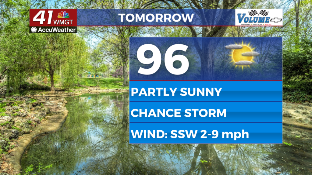
Tomorrow
Even more sunshine is expected Friday afternoon however scattered cumulus clouds will still fill in during the lunchtime hours. Rain odds will be quite low with only about a 5th of the region having a chance for storms. Highs will largely reach the upper 90s and a location or two hitting 100 cannot be ruled out. Real feels should eclipse 100 for most of Middle Georgia.


Overnight should be clear with lows again expected in the mid 70s for the most part. Wind will be light from the southwest at 5-10 mph.
This Weekend and Beyond
The next heat wave will begin over the weekend with some spots possibly reaching 100 by Saturday afternoon and most locations reaching that mark by Sunday. Rain odds will be very low and there is a solid chance we see no rain at all. UV Index values will likely be around 12-13, so 15 minutes or less before skin starts to burn from sun exposure. Hydration will also be key to staying safe in the major heat. A heat advisory will be possible over the weekend and likely into next week.
Watching the Tropics
The low pressure responsible for the brief cooldown yesterday is moving back over the gulf. Odds of development are still at 10% over the next 7 days.

Follow Chief Meteorologist Aaron Lowery on Facebook (Aaron Lowery 41NBC) and Twitter (@ALowWX) for weather updates throughout the day. Also, you can watch his forecasts Monday through Friday on 41NBC News at 4, 5, 5:30, 6, and 11 p.m.


