

Storm chances lessens as temperatures head up
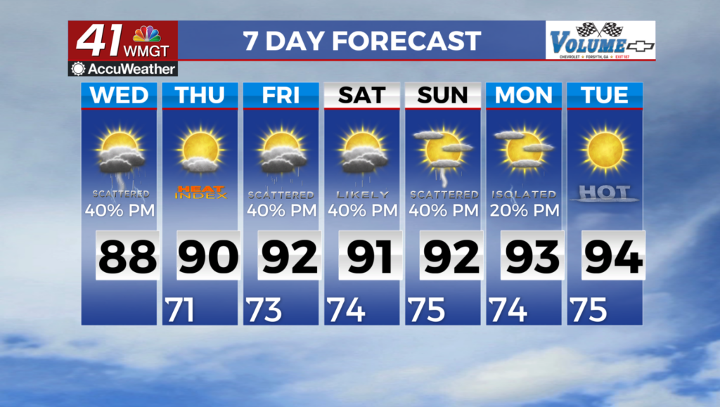
MACON, Georgia (41NBC/WMGT) -For our Wednesday, the overall environment will change little with the air you can wear persisting. Diurnally enhanced scattered showers and thunderstorms 


are again expected to peak during the afternoon and early evening hours. Coverage is expected to be considerably lower as a weak low continues to depart farther westward and the weak suppressing effect of high pressure nudging in from the northeast will also work against more widespread coverage. Given less overall convective coverage, highs will begin an upward trend, remaining largely in the mid to upper 80s, several degrees below normal for mid-July. A fairly typical summer convective pattern for Georgia resumes for the long term period, featuring daily 

chances of scattered afternoon and evening showers and thunderstorms for the rest of the week and through the weekend. Organized severe weather is not expected at this time, but instability will be available especially as slightly less convective coverage allows cloud cover to be more broken with a bit more heating, so a few storms could still produce damaging winds. By early next week, persistent longwave ridging is forecast to set up and become more dominant over the Western U.S., placing Georgia in a northwest flow pattern with the potential for disturbances to ride over the downside of the east side of the ridge, better focusing convective chances at times. A larger and stronger low pressure system moving across the northeast mid to late next week may also eventually be able to send a cool front down across the southeast with drier, less humid conditions, although the details are not yet clear at this time.