
Storm chances increase Tuesday for parts of Middle Georgia
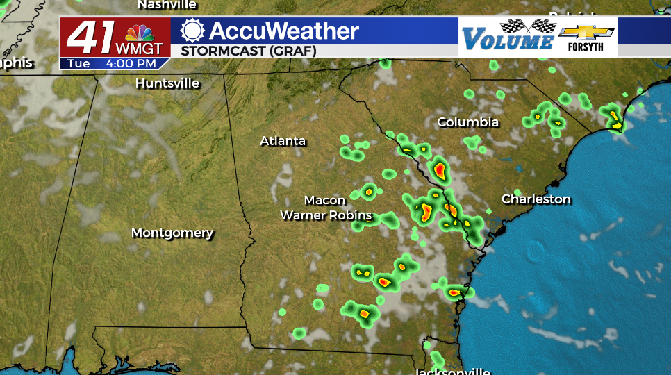
MACON, Georgia (41NBC/WMGT) – Some parts of Middle Georgia could see rain to help cool off Tuesday afternoon.
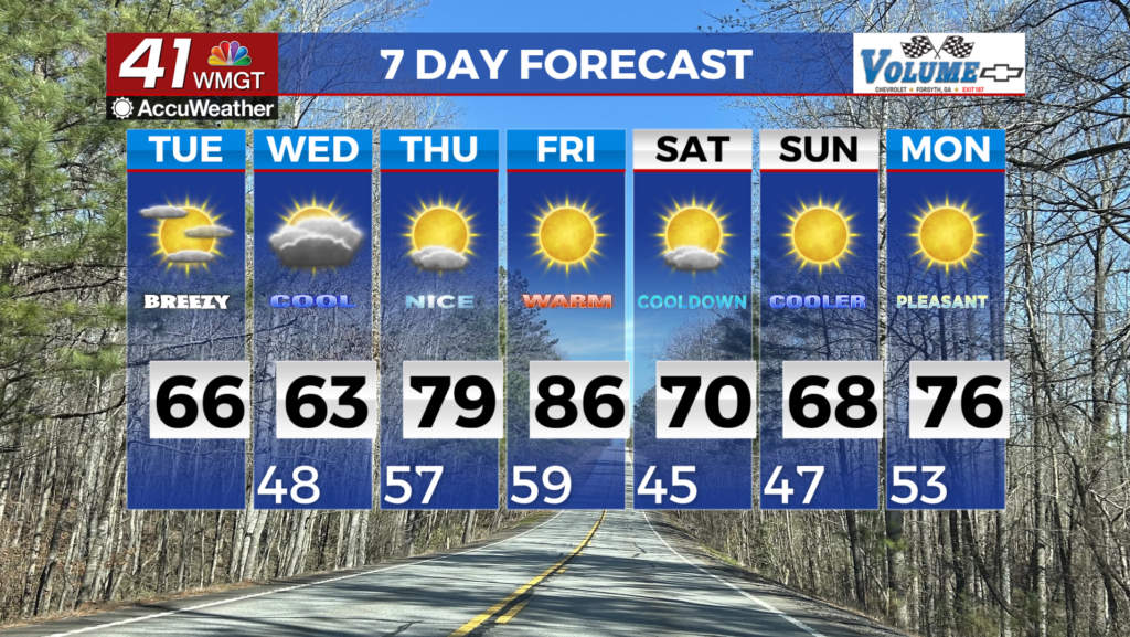
Mostly sunny skies are likely for the western half of the region while partly cloudy skies are more likely further east. High temperatures will reach the low 90s across the region this afternoon with heat indexes in the upper 90s. Ambient winds will mainly come from the north-northeast at around 5 mph.


A Level 1 “Marginal” risk for severe weather is in effect for the southeastern counties in Middle Georgia this afternoon. The eastern third of the region is most likely to see storms today with locations along and west of I-75 likely not seeing any rain. Storms can bring lightning, small hail, and a few strong wind gusts.


Storm activity will subside ahead of tonight with mostly clear conditions likely heading into Wednesday morning. There is a full moon tonight: the Full Sturgeon Moon, named for the fish that was once plentiful in North American rivers and lakes.


That moon may appear a bit hazy as Wednesday morning approaches, however; some wildfire smoke moving into the region from the north could make for a less than optimal start to Hump Day. Teachers of young students in the area may want to be mindful of this when it comes to recess as young children are one of the sensitive groups to lower air quality. Low 70s out the door will be relatively dry thanks to the hazy conditions.


Rain chances will remain low on Wednesday, however cloud cover will increase a bit as moisture returns to the region with winds out of the south. Rain chances will elevate more Thursday and Friday.

Follow Meteorologist Aaron Lowery on Facebook (Aaron Lowery 41NBC) and Twitter (@ALowWX) for weather updates throughout the day. Also, you can watch his forecasts Monday through Friday on 41NBC News at Daybreak (5-7 a.m.) and 41Today (11 a.m).