Storm chances drop some Friday
MACON, Georgia (41NBC/WMGT) –
This Evening


Storms began firing off during the mid afternoon today and will become more widespread as the evening progresses. While severe weather is not overall expected, a few storms may have some hail or a couple of strong wind gusts. There is no tornado threat. Storms may linger after midnight for a few Middle Georgians, however all activity should be gone by tomorrow morning.


Aside from storms this evening it will be a partly cloudy and muggy night. Wind will be gentle from the southeast which will again allow for the possibility of fog. Fog will be more likely in areas that get rain this evening. Low temperatures will again be the lower 60s across the region.
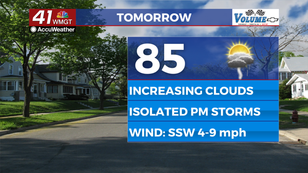
Tomorrow


Friday will be a bit nicer as less clouds are expected overall and rain chances will be reduced from the couple of days prior. A few storms will still be possible over the back half of the day, however. Highs will reach the mid to upper 80s with wind expected to be light from the south-southwest.


Overnight will be mostly cloudy with a couple of storms possible into the midnight hour or beyond. Lows will be in the lower 60s accompanied by light and variable winds. Overnight fog is probable.
This Weekend


Partly cloudy skies will go along with warm and humid conditions after the rain from this week. Expect mosquito numbers to be up for anyone going out in the mornings or evenings as a result. Storm chances will be reduced from what was seen this work week, however both days will likely still feature some isolated activity. This pattern will carry into next week.

Follow Chief Meteorologist Aaron Lowery on Facebook (Aaron Lowery 41NBC) and Twitter (@ALowWX) for weather updates throughout the day. Also, you can watch his forecasts Monday through Friday on 41NBC News at 4, 5, 5:30, 6, and 11 p.m.


