Slim chance for a shower or storm Thursday
MACON, Georgia (41NBC/WMGT) – As a summer-like pattern takes over the southeastern US temperatures and rain odds will climb towards the end of the week.
This Evening
It was a much warmer day around Middle Georgia following a foggy start. Conditions should stay pretty clear through the evening and overnight with low temperatures likely in the lower 50s for much of the region. The wind will be light from the south-southeast. Some fog will again be possible overnight and into the start of Thursday.
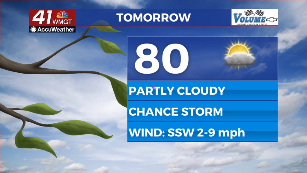
Tomorrow
Temperatures and humidity will climb more Thursday afternoon with highs likely in the upper 70s and lower 80s. Overhead skies will be clear early (fog possible at the surface) with scattered cumulus expected in the afternoon. The wind will be light from the south-southwest around 5-10 mph. Rain odds will be limited to a couple of stray showers or perhaps a thunderstorm or two. No severe weather is expected.


Overnight will be mostly clear and rather warm with low temperatures anticipated in the upper 50s for most of the region. The wind will shift back to the south-southeast around 5-10 mph. Once again fog will be possible leading into the next morning, including dense fog.
Friday and Beyond
More of the same is expected Friday and into the weekend however the odds for isolated storms will be higher than Thursday. Overall each day about 1/3 of Middle Georgia should see rain/storms. Pollen levels will continue to climb as the warm pattern will carry into much of next week.

Follow Chief Meteorologist Aaron Lowery on Facebook (Aaron Lowery 41NBC) and X (@ALowWX) for weather updates throughout the day. Also, you can watch his forecasts Monday through Friday on 41NBC News at 4, 5, 5:30, 6, and 11 p.m.