Shower odds climb tonight/tomorrow; storms likely Friday
MACON, Georgia (41NBC/WMGT) – A slow moving cold front is approaching the southeast bringing showers and eventually thunderstorms to the Peach State.
This Evening


Cloud cover has continued to increase throughout the afternoon today. Despite this it has been rather warm with temperatures approaching 70 degrees. The strong breezes from the southwest will continue overnight as gusts over 20 mph will remain possible. Shower odds will increase after midnight, however any rain seen leading up to Thursday morning should be light and short lived. Low temperatures will take a major jump from the past couple of nights as the valleys should be in the mid to upper 50s.
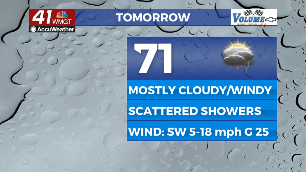
Tomorrow


Shower activity should be isolated in the morning, however getting into the afternoon and evening more widespread scattered activity is likely. Temperatures will largely peak in the upper 60s and lower 70s under mostly cloudy skies. A few pockets of sunshine are likely over the back half of the afternoon. The wind will remain strong from the southwest ranging from 5-20 mph. Gusts could push as high as 30 mph.


Overnight showers will continue with heavier rain likely to move in an hour or two before sunrise on Friday. Thunder and lightning will be likely once this heavier rain begins. Low temperatures will be in the upper 50s and lower 60s leading into Friday morning.
Friday and Beyond


The actual cold front will arrive during the early hours of the day and slowly push southeast through Middle Georgia as the day progresses. The heaviest rain is currently expected in the morning-lunchtime hours, tapering off as the evening goes on. A few showers will remain possible overnight into Saturday morning. Expect cloud cover to linger into at least lunchtime on Saturday or possibly later depending on how slowly the front does move through on Friday.

Follow Chief Meteorologist Aaron Lowery on Facebook (Aaron Lowery 41NBC) and X (@ALowWX) for weather updates throughout the day. Also, you can watch his forecasts Monday through Friday on 41NBC News at 4, 5, 5:30, 6, and 11 p.m.