


Severe weather chances for Saturday low but still there
MACON, Georgia. (41NBC/WMGT) – The final storm system of the week is arriving as we head into the weekend.
Today
It was another morning in Middle Georgia in which the majority of residents woke up to rainfall. Showers moved in as a warm front passed through the Peach State, adding plenty of heat to the Georgia atmosphere and kicking off the morning with temperatures in the upper 40s and lower 50s. The humidity will only continue to rise as the wind will blow from the south at about 5-10 mph all day today. High temperatures this afternoon will range from the mid 60s into the mid 70s with locations further north remaining slightly cooler due to more rainfall expected. The skies will remain mostly cloudy though a couple of small pockets of sunshine may form this afternoon. Most of the rain is also moving through early, but a few isolated showers are possible around the region this afternoon and evening.


Overnight the winds will shift more to the south-southwest while slightly increasing in speed. Cloud cover will remain abundant and a few showers may persist through the overnight hours. This will keep things very warm heading into Saturday morning, only dropping low temperatures into the low to mid 60s, which is warmer than most of our highs were on Thursday.
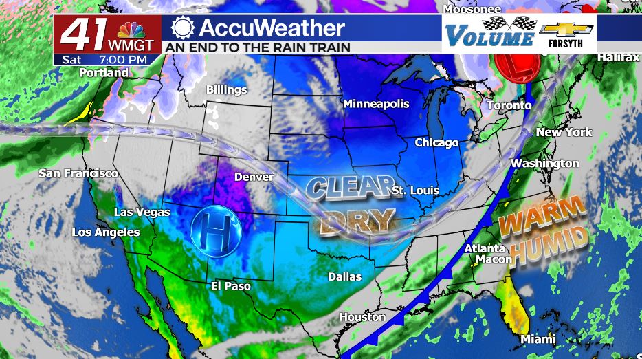
Saturday
Saturday will begin on a cloudy note with a few isolated showers, continuing the wet morning trend we have dealt with all week in Middle GA. The winds will shift further to the west as well as pickup more speed ahead of the lunchtime hours, now blowing out of the southwest at 10-15 mph with gusts that could reach 25 mph. During the afternoon hours there will be plenty of heat despite the cloud cover as temperatures climb into the mid to upper 70s around the region. The good news is the cloud cover and shower activity will limit severe weather potential; only the northernmost counties in the region are in the Level 1 Risk zone ahead of the cold front which will arrive after sundown. Thunderstorm activity will likely begin in Middle GA during the dinnertime hours with independent cells; that is when the tornado threat is highest (it’s still extremely low).


Once the main line of thunderstorms arrives during the early overnight hours, the winds will shift to the northwest at about 10-15 mph with gusts in excess of 20. These will immediately begin to feed cold and dry air into the Georgia atmosphere and clear out the clouds and humidity. Temperatures around the region will fall into the 40s ahead of the sunrise on Sunday, but a handful of clouds will still remain to begin the back half of the weekend.
Sunday
Finally, the long awaited return of the sunshine is over. The sun will be back across most of Middle GA by 11 am the latest on Sunday in the form of clear skies. Temperatures will be a lot cooler than Friday and Saturday as highs clock in at just above 60 degrees for most of Middle GA. The wind will shift to the north-northeast around 5 mph, finally ending the strong breezes that began on Friday night. Low temperatures Sunday night will be much more seasonable, falling into the low to mid 30s around the region.


Pleasant weather will persist into the first half of next week as a ridging pattern in the jet stream takes hold over the Southeastern US. This should keep rain chances negligible until at least Thursday, and at this time it looks as though the late week rain chances will remain limited. Temperatures, however, will remain above the average high of 61 for most of next week in Macon with some 70s potentially returning late week.

Follow Meteorologist Aaron Lowery on Facebook (Aaron Lowery 41NBC) and Twitter (@ALowWX) for weather updates throughout the day. Also, you can watch his forecasts Monday through Friday on 41NBC News at Daybreak (6-7 a.m.) and 41Today (11 a.m).


Leave a Reply