


Severe storms possible early Wednesday
MACON, Georgia (41NBC/WMGT) – An incoming cold front will bring a line of storms capable of producing powerful winds and perhaps a brief tornado early Wednesday.
This Evening
Mostly cloudy skies are expected to stick with Middle Georgia through the sunset as temperatures stay in the lower 70s and upper 60s. Wind will also remain pronounced from the south-southeast at 10-20 mph, gusting over 30 mph at times. Due to the stronger winds there is a Wind Advisory in effect until 7 PM Wednesday evening. Along with the wind a stray shower or two late this evening cannot be ruled out.
Overnight
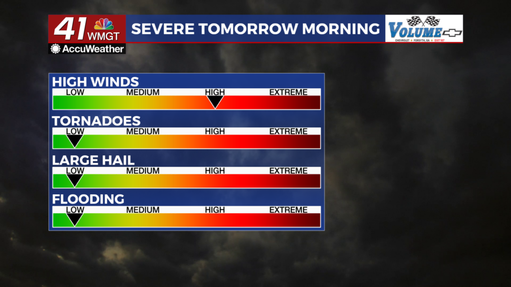
By midnight most of Middle Georgia will have only seen clouds and wind so far (save for those who saw a stray shower). The first storms will likely start to enter Middle Georgia between 3-4 AM with the line fully arriving at around 4. The southwestern and southeastern counties are included in a Level 2 “Slight” risk between the Day 1 and Day 2 SPC risks. The rest of the counties fall in a Level 1 “Marginal” risk.


The primary threat with storms tonight will be straight line winds. Gusts will likely be around if not more than 60 mph. There will be plenty of lightning and thunder as well. The tornado risk is pretty low overall, however the southwestern counties of Middle Georgia will have slightly higher odds in that department. Any hail should remain small. Ambient wind outside of storms will also be rather powerful as it flows from the south at 10-30 mph. Gusts will push over 40 mph.
Tomorrow
Storms will be clearing the region by 10 am, and following that clouds will work to clear out through the afternoon and evening. Expect highs in the low to mid 70s as wind continues to be rather strong from the west-southwest (10-25 mph gusting 30+).


Overnight skies will feature scattered clouds as temperatures keep plunging into the mid to upper 30s. Wind will still be quite pronounced from the west-northwest at 10-20 mph. Gusts will range from 20-30 mph.
Thursday and Beyond
Thursday will be cool and also a bit windy. Highs will hover around the 60 degree mark with northwest wind blowing in at 10-17 mph. Gusts will likely range from 20-25 mph.

Follow Chief Meteorologist Aaron Lowery on Facebook (Aaron Lowery 41NBC) and Twitter (@ALowWX) for weather updates throughout the day. Also, you can watch his forecasts Monday through Friday on 41NBC News at 4, 5, 5:30, 6, and 11 p.m.


