Scattered storms possible this evening
MACON, Georgia (41NBC/WMGT) – An incoming cold front will instigate scattered storms this evening and overnight.
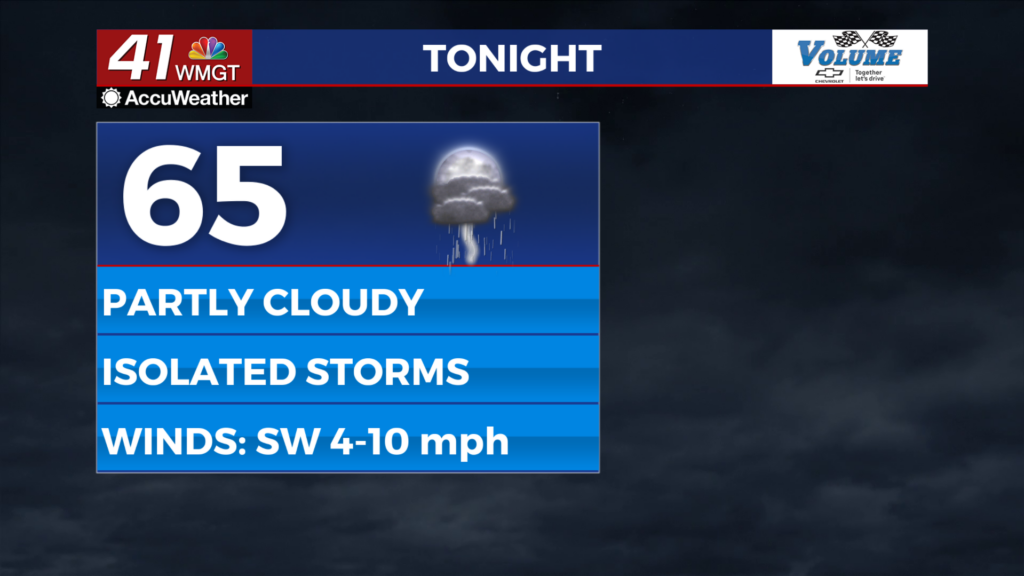
This Evening


Mostly cloudy skies will hang with Middle Georgia through the rest of Tuesday and into the overnight hours. Isolated to scattered storms will likely fire up during the suppertime hours, becoming more widespread from about 10 pm until 2 am. For tonight’s storms, a Level 1 “Marginal” risk has been issued for all of Middle Georgia. This is due to the potential for a couple of storms to become strong to severe. They could bring a few strong wind gusts or some hail.


Outside of storms overnight skies will be partly cloudy with low temperatures and dew points in the mid to upper 60s. Ambient wind will be out of the southwest at about 5-10 mph, gusting to about 17 mph. Rain activity should cut off ahead of tomorrow morning.
Tomorrow


Partly cloudy skies are likely through the afternoon as a few isolated showers or perhaps a thunderstorm pop up during the middle to late parts of the afternoon. No severe storms are expected. Highs will reach the mid 80s around the region with westerly wind at 5-15 mph, gusting upwards of 25 mph.


Overnight leftover clouds will work to clear out as temperatures drop into the lower 60s for most of the region. Winds will come from the northwest at about 3-10 mph.
Thursday and Beyond


Thursday will be mostly sunny and hot with highs into the upper 80s and potentially lower 90s. Clouds will return overnight as Friday could see more rain arrive, especially in the evening. Saturday also looks to bring numerous storms before nicer weather returns on Sunday.

Follow Meteorologist Aaron Lowery on Facebook (Aaron Lowery 41NBC) and Twitter (@ALowWX) for weather updates throughout the day. Also, you can watch his forecasts Monday through Friday on 41NBC News at 4, 5, 5:30, 6, and 11 p.m.


