Scattered storms likely Wednesday afternoon and evening.
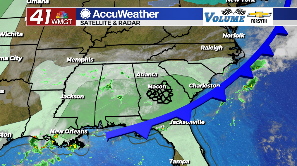
MACON, Georgia (41NBC/WMGT) – Much of Middle Georgia will see several small thunderstorms over the back half of the day today.
Today


Mostly cloudy skies will hang with Middle Georgia into the lunchtime hours. A few pockets of sunshine will likely increase in a size a bit during the lunchtime hours before storms begin to form late this afternoon. Highs will reach the low to mid 80s around the region with ambient winds out of the west-northwest at about 5-10 mph. Storms should be short lived, however each one can bring upwards of an inch of rainfall as well as some small hail and a couple of wind gusts. Some areas could get hit more than once.


Tonight a few storms will linger, and some showers may develop overnight. Winds will be calm and variable around the region with low temperatures down into the mid 60s for most of the region. Fog is likely for much of the region late tonight and into tomorrow morning.
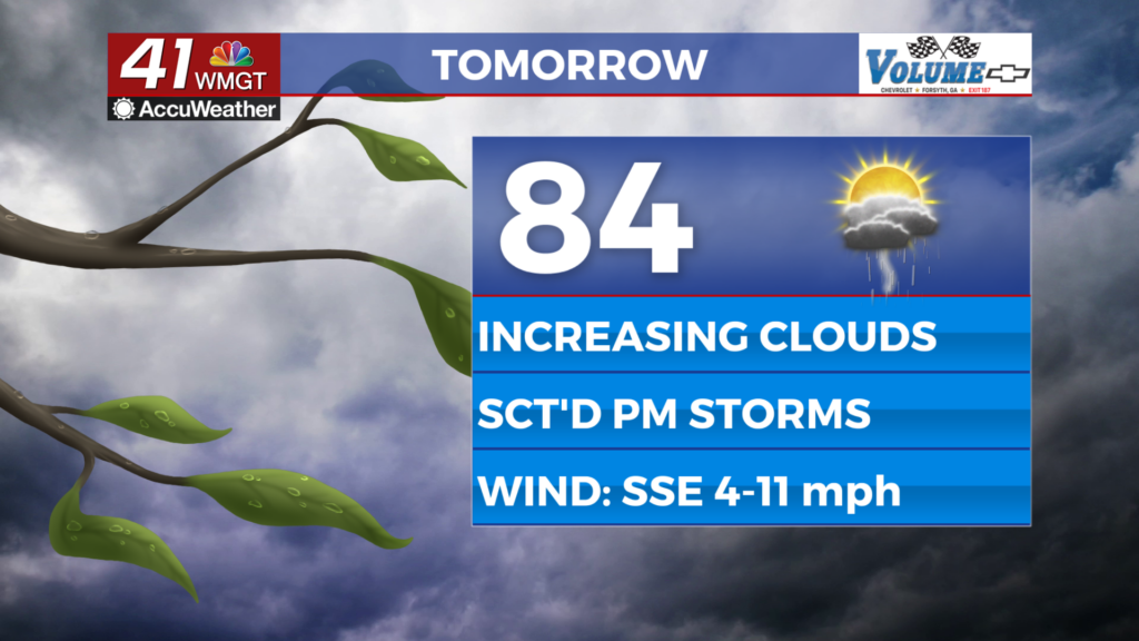
Tomorrow


Thursday will likely be the wettest day of the week for Middle Georgians. It will also be the coolest and the cloudiest with temperatures likely only climbing into the lower 70s for most of the region. High pressure to the north is driving cold and humid air from the Maritime Atlantic into the eastern side of the Appalachian Mountains resulting in cold air-damming. This results in the air being forced to condense creating a thick layer of low-level clouds over the majority of the Peach State. For the northern third of the state the rain will largely be showers, however in Middle Georgia we will likely see a few showers early and then a mix of showers and thunderstorms in the afternoon. Ambient winds will be rather strong out of the east-northeast as they come in at about 5-15 mph (gusts could push 30 mph) throughout the afternoon and evening.


Some showers could linger into the overnight hours, however by that point thunderstorm activity should come to a stop. Temperatures will bottom out in the lower 60s around the region. While there will be plenty of moisture for fog development, the winds out of the east at about 5-12 mph may be too much for it to develop.
Friday and Beyond


Friday will start off on a cloudy note however things should get a bit nicer over the back half of the day. With the aforementioned high pressure further northeast, rain chances will drop and the clouds should break in the middle of the day. Highs will largely reach the upper 70s and lower 80s with overnight lows again dropping into the lower 60s.
Over the weekend temperatures will rebound into the 80s. Saturday will see storm chances ramp up in the evening and overnight as a weak cold front passes through the area. While this front will not drop temperatures heading into Sunday/next week, it will keep overnight lows in the lower 60s vs the upper 60s/lower 70s the region has seen for the past week and a half.

Follow Meteorologist Aaron Lowery on Facebook (Aaron Lowery 41NBC) and Twitter (@ALowWX) for weather updates throughout the day. Also, you can watch his forecasts Monday through Friday on 41NBC News at Daybreak (5-7 a.m.) and 41Today (11 a.m).