Scattered storms likely this evening around Middle Georgia
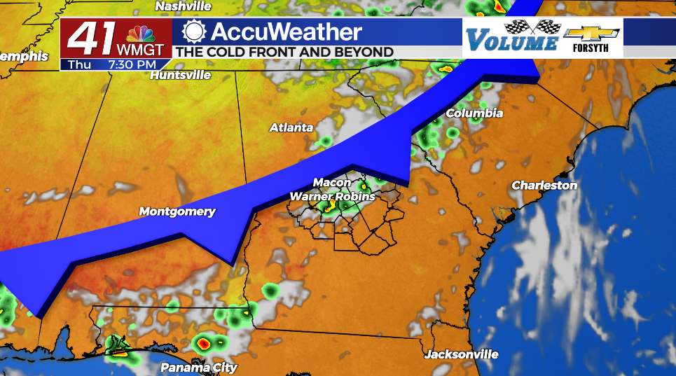
MACON, Georgia (41NBC/WMGT) – An incoming cold front will bring scattered storms to Middle Georgia through this afternoon and into tonight.
Today
A sunny start for most of Middle Georgia will allow temperatures to rise into the lower 90s this afternoon. Heat indexes will reach into the upper 90s, however. It will be the muggiest day of the week due to the incoming cold front. Ambient winds today will largely come from the west-southwest at about 5-15 mph. Scattered clouds will begin to fill into the skies during the lunchtime hours.


A Level 1 “Marginal” risk for severe weather includes all of Middle Georgia this afternoon and evening. Small hail and strong wind gusts will be the main concerns. Rain will begin in the northern counties during the late afternoon, developing into thunderstorms heading into the evening. The rain will push southeast through the evening and overnight. A bit of rain my linger in the southeastern counties heading into tomorrow morning.


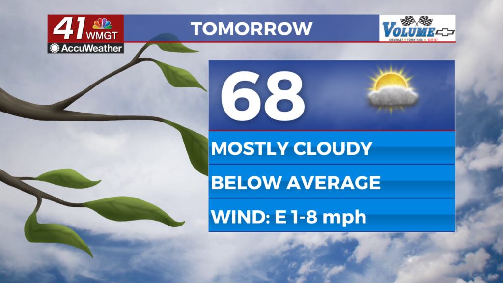
The northwestern counties will clear out during the overnight hours, allowing temperatures to drop into the mid to upper 60s. Some spots further southeast could be a little warmer due to lingering cloud cover come Friday morning.
The Tropics
Hurricane Lee has developed and its track to the west-northwest through Sunday night would put it just north of Puerto Rico. A curve to the north early next week looks increasingly likely, however the storm avoiding a US Landfall is not a guarantee.

Invest 96-L will likely earn the name Margot within the next 24 hours. Expect it to follow a similar track to Lee, at least early on.

Follow Meteorologist Aaron Lowery on Facebook (Aaron Lowery 41NBC) and Twitter (@ALowWX) for weather updates throughout the day. Also, you can watch his forecasts Monday through Friday on 41NBC News at Daybreak (5-7 a.m.) and 41Today (11 a.m).