
Scattered storms and heat remain in the forecast for Thursday
It was another hot day across Middle Georgia with highs in the upper 90’s and high humidity. Not only that, but we are once again seeing pop up showers and storms this evening.
Tomorrow will bring more of the same, with perhaps more widespread storm activity. Feels like temps will once again make it into the mid and upper 90’s by the afternoon with storms helping to cool things down a bit as they pop up.
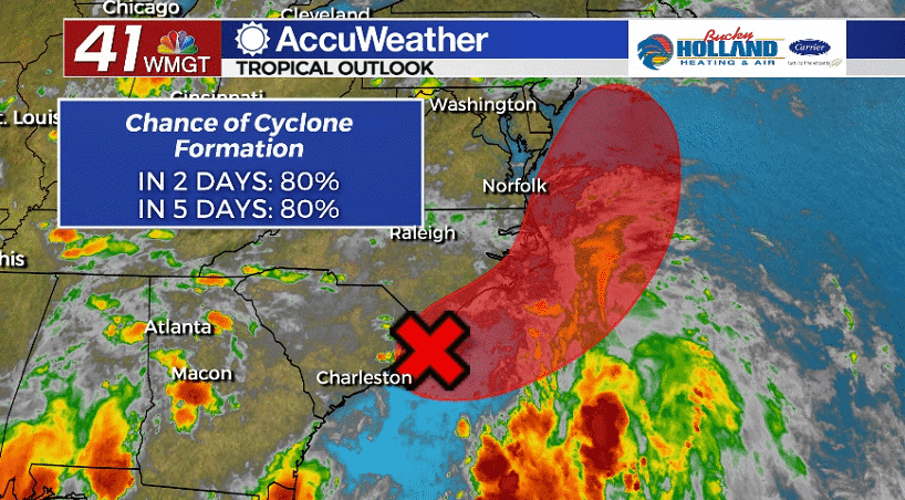
Through the week we have been tracking an area of low pressure that originated in the Gulf of Mexico. That low has now moved to the Atlantic and is poised to become the next tropical cyclone.
The National Hurricane Center gives this area of low pressure an 80% chance of becoming a tropical cyclone as of 8pm. Regardless of whether this storm gets a name, it is likely to bring heavy rain to the east coast.
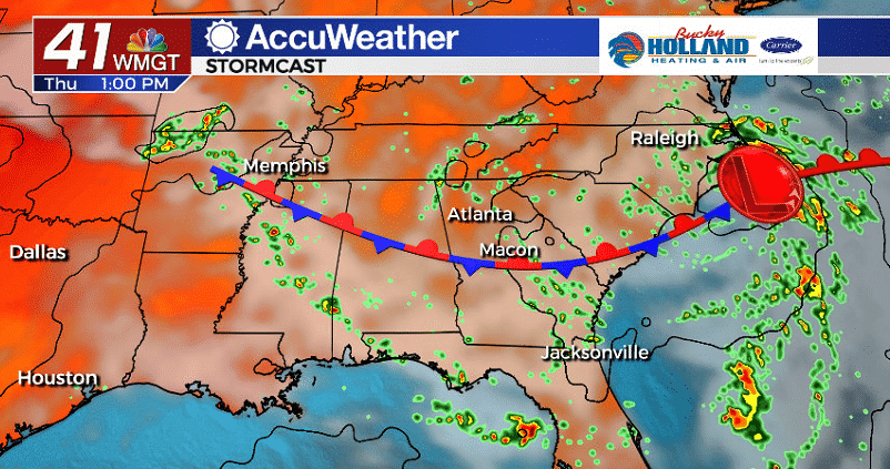
That tropical low will continue to influence our weather through the next few days as it continues to draw in tropical moisture. This will continue our pattern of scattered storms and high humidity.
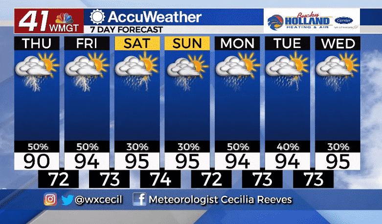
Looking ahead to the weekend, we will be cranking the heat up to the mid 90’s, but heat indices will soar into the 100’s. Scattered storms will make an appearance in the forecast through much of next week.

Leave a Reply