Scattered storms continue Wednesday
MACON, Georgia (41NBC/WMGT) – Another round of scattered storms is likely Wednesday afternoon.
This Evening


Storm activity hasn’t been too widespread thus far this afternoon, however that could change through the evening and into tonight. Severe storms are not expected however the strongest ones may have decent wind gusts. Wind will largely flow from the south-southwest heading into tonight around 5 mph. Low temperatures will be in the low to mid 70s around the region again with the possibility for fog ahead of sunrise Wednesday.
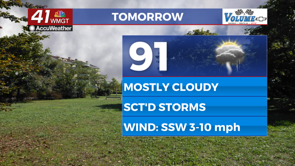
Tomorrow


Wednesday is expected to be partly to mostly cloudy with another round of scattered storms through the afternoon and the evening. Highs will push into the upper 80s and lower 90s with heat indexes again reaching the upper 90s and low triple digits. Wind will continue from the south-southwest at 5-10 mph.


Overnight will also be mostly cloudy with the possibility for a few lingering showers or storms early on. Low temperatures will again fall into the low to mid 70s accompanied by light wind from the south.
Thursday and Beyond


A bit more sun is likely over the final two days of the work week however close to half the region will continue to see storm odds in the afternoon and evening. Wind will be light from the west on Wednesday before becoming northwesterly on Thursday. Temperatures should largely get into the 90s over the last two days of the week as well.
Watching the Tropics


Tropical Storm Erin doesn’t look all that impressive at this time, however gradual strengthening is still expected over the course of the week and into the weekend and bears watching by locations on the US East Coast as well as the Caribbean Islands.

Follow Chief Meteorologist Aaron Lowery on Facebook (Aaron Lowery 41NBC) and Twitter (@ALowWX) for weather updates throughout the day. Also, you can watch his forecasts Monday through Friday on 41NBC News at 4, 5, 5:30, 6, and 11 p.m.