Rain tonight/tomorrow; powerful winds Sunday
MACON, Georgia (41NBC/WMGT) – An incoming low pressure system will bring rain over the first half of the weekend before the associated cold front plummets temperatures Sunday.
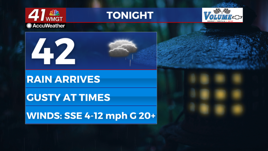
This Evening


What has been a sunny afternoon will see cloud cover ramp up through the suppertime hours. While these will initially be high cirrus clouds, thicker mid and low level clouds will quickly fill in behind them. Some light showers may begin to arrive ahead of midnight tonight, however the heaviest rain is expected through the early morning hours Saturday and through the sunrise. Overnight lows will be in the low to mid 40s, making tonight the first night this week with lows across the board above freezing. Wind will flow from the south-southeast at 5-10 mph, gusting as high as 20 mph through the night.
Tomorrow


It’ll be a wet start to Saturday across Middle Georgia as some of the heaviest expected rain with the upcoming system will be ongoing. Rain from the overnight hours should subside during the late morning/early lunchtime hours, however another round of scattered showers and thunderstorms will be possible over the back half of the day.


This will be after temperatures peak in the 60s across the region. Severe weather is not expected, however lightning and thunder are fair game. Ambient winds will be out of the south at 5-12 mph, gusting upwards of 25 mph.


Overnight a few showers will linger, even past midnight. It will be the warmest night of the week with lows expected in the mid to upper 40s across Middle Georgia. Wind will be flow mor out of the west at around 5-10 mph, gusting to around 20 mph.
Sunday and Beyond


Sunday will see high temperatures during or not long after sunrise as the wind shifts to the northwest early on. These highs will be in the mid to upper 50s, however afternoon temperatures will largely be in the 40s. The aforementioned winds will flow in at 10-20 mph, gusting as high as 40 mph across the region. The air these strong winds bring will be cold and dry, so clouds from the morning will work to clear out some during the later parts of the day. Overnight will be absolutely frigid with temperatures falling below freezing ahead of midnight and eventually stopping in the lower 20s. Middle Georgians are suggested to drip their faucets and bring in any pets and small plants from the extreme cold. Winds will still be blustery from the north-northwest at 8-15 mph, gusting upwards of 25-30 mph. These winds will likely lead to wind chills in the low teens out the door Monday morning.
Expect the cold to stay into next week with a shot at some snowfall Tuesday.

Follow Chief Meteorologist Aaron Lowery on Facebook (Aaron Lowery 41NBC) and Twitter (@ALowWX) for weather updates throughout the day. Also, you can watch his forecasts Monday through Friday on 41NBC News at 4, 5, 5:30, 6, and 11 p.m.


