


Rain to continue tonight; storms likely tomorrow
MACON, Georgia (41NBC/WMGT) – A warm front will keep showers rolling tonight and an incoming cold front may spur on storms late Tuesday.
This Evening and Tonight
It’s been a wet start to the week for Middle Georgia and that will continue through tonight and tomorrow. Tonight’s rain will be widespread and moderate for most locations. Temperatures will valley in the upper 50s and lower 60s through tonight. Wind will remain out of the south-southwest at 5-12 mph, gusting over 20 mph. Most of the region can expect around an inch of rain by sunrise tomorrow. Locally heavier amounts are also possible.
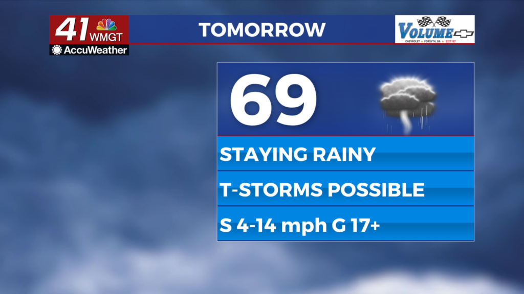
Tomorrow
Showers will be likely over the first half of the day with storms more likely in the evening and overnight. Expect highs in the upper 60s and lower 70s with wind from the south expected at 10-15 mph, gusting over 25 mph.
The strongest winds will be likely overnight and into Wednesday morning as the cold front passes through. A Level 1 “Marginal” threat for severe weather includes the western half of Middle Georgia. This is mainly due to the wind gust threat. Flash flooding in low lying areas also cannot be ruled out. Overnight lows will drop into the upper 40s and lower 50s with wind continuing from the south-southwest at 10-17 mph and gusting over 30 mph.
Wednesday and Beyond
Rain may be ongoing as Wednesday begins thanks to the cold front moving through, however the rain should all clear out by lunchtime. Conditions will likely stay cloudy into the lunchtime hours before clearing into the night. Drier and cooler conditions will stay with Middle Georgia on the back side of the front Thursday and Friday.

Follow Chief Meteorologist Aaron Lowery on Facebook (Aaron Lowery 41NBC) and Twitter (@ALowWX) for weather updates throughout the day. Also, you can watch his forecasts Monday through Friday on 41NBC News at 4, 5, 5:30, 6, and 11 p.m.
