Rain chances return again for the weekend
MACON, Georgia (41NBC/WMGT) – An incoming cold front is expected to stall out over the northern half of Georgia this weekend and bring some rain to much of the state.
This Evening


A partly sunny afternoon and hot afternoon will lead into a warm and muggy night that will see cloud cover increase leading up to Sunday morning. Many low temperatures around the region will be just below the 70 degree mark. The warmest spots may stay above 70. Wind will be a bit breezier from the southwest at 6-12 mph. Gusts could push 20 mph through the night. No rain is expected tonight, however some activity could be possible in the northern counties of Middle Georgia by the sunrise tomorrow.
Tomorrow


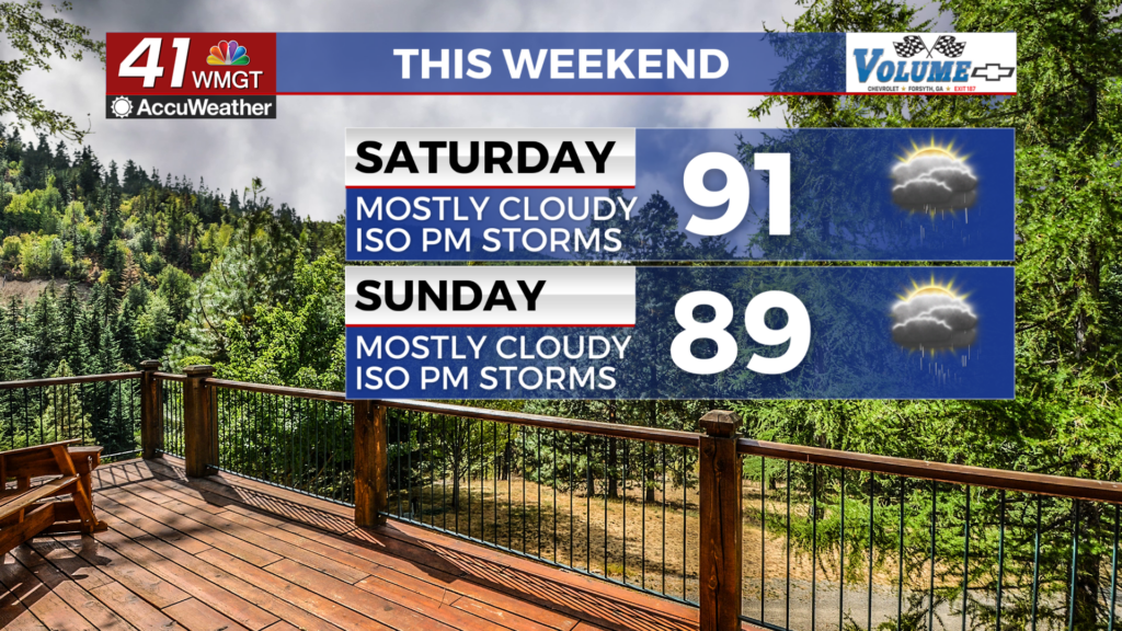
Saturday will feature a lot more cloud cover than the past two days, however temperatures should still reach into the lower 90s for most of the region. Heat indexes will largely be in the low to mid 90s. Wind will be breezy from the west-southwest at 10-15 mph, gusting as high as 25 mph.


Storms will also be possible in the later part of the day (as well as the aforementioned morning showers). For these storms a Level 1 “Marginal” risk for severe weather includes the entirety of Middle Georgia. The main hazards will be some hail or a few wind gusts.


Overnight leftover storms should turn to showers before dissipating. It will be a very warm night with lows expected to hover just below or at the 70 degree mark. Wind will be a lot calmer at around 5 mph from the west.
Sunday and Beyond


The back half of the weekend will also be mostly cloudy and feature another round of rain. With the front being a bit more south the rain odds on Sunday will be a bit more widespread than Saturday. A Level 1 “Marginal” threat includes the entirety of Middle Georgia for Sunday as well.
Next week will start off hot and partly cloudy before a midweek cold front will bring the next opportunity for rain.

Follow Chief Meteorologist Aaron Lowery on Facebook (Aaron Lowery 41NBC) and Twitter (@ALowWX) for weather updates throughout the day. Also, you can watch his forecasts Monday through Friday on 41NBC News at 4, 5, 5:30, 6, and 11 p.m.


