Plenty of rain expected Friday
MACON, Georgia (41NBC/WMGT) – A gulf low pressure system will bring plenty of rain to Middle Georgia to end the week.
This Evening


More cloud cover will continue to move in this evening, turning a partly cloudy day into an overcast night. Spotty showers will also remain possible throughout the evening. The overall odds for showers will increase a bit further after midnight. Lows will be in the upper 60s and lower 70s with wind out of the northeast coming in at 10-15 mph, gusting as high as 20 mph.
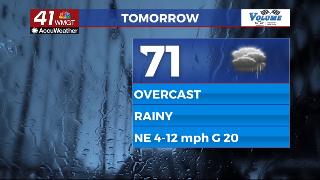
Tomorrow


The cloudiest day of the week will also be the rainiest. The morning hours may feature a few isolated showers, but more widespread stratiform rain will start moving in around lunchtime. Some of the heaviest rain will arrive in the evening and early overnight hours, accompanied by wind gusts of up to 25 mph. Temperatures likely will not reach above the mid 70s in the afternoon in the warmest spots. Thunder and lightning are not expected with the rain tomorrow, however it cannot 100% be ruled out.


Overnight rain will continue along with relatively strong breezes out of the north-northeast. Expect the wind to shift more towards the north-northwest heading into Saturday morning. Lows will be in the mid to upper 60s. If there is going to be thunderstorm activity, the best opportunity will be early Saturday morning as the wind shifts direction. That will indicate the cold front with this system moving through, and it could instigate a couple of thunderstorms in the southeastern counties of the region.
Saturday and Beyond


Rain will be ongoing as the day begins with the southeastern counties of Middle Georgia potentially seeing a bit of thunderstorm activity ahead of lunchtime. Those storms should be the last of the rain for the day save for a couple of tiny showers behind the front. Cloud cover will stick around during the day, however, likely keeping highs in the upper 70s and lower 80s.

Sunday should see overall nicer conditions as the system clears the Atlantic seaboard.
The Tropics

There are now FIVE areas of interest in the Atlantic Basin. Area A is what will bring the the Peach State rain this weekend. B is not of concern to Georgia; it’s too far north. C has plenty of time to develop and does warrant watching, however E is closer and would bring a more immediate impact should it come this direction. Finally, D should also not be of concern to Georgia. All five spots currently have less than a 40% chance to develop over the next 7 days.

Follow Meteorologist Aaron Lowery on Facebook (Aaron Lowery 41NBC) and Twitter (@ALowWX) for weather updates throughout the day. Also, you can watch his forecasts Monday through Friday on 41NBC News at 4, 5, 5:30, 6, and 11 p.m.


