Pleasant weekend on deck for Middle Georgia
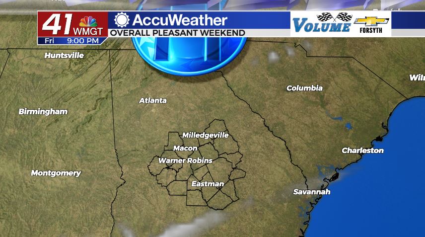
MACON, Georgia (41NBC/WMGT) – Benign weather conditions are taking over Middle Georgia following Thursday’s cold front.
This Evening


Sunshine has filled the Georgia skies so far today, and it will continue to do so until it sets. Cloud cover will remain very limited over the next 18 hours or so, so conditions will remain clear overnight as well. It will get a little chilly tonight as the northwest winds make a shift towards the northeast. The good news is the speed will remain rather calm, hovering around the 5 mph mark. Anyone with late night plans should plan for temperatures in the mid 50s with a slight wind chill. By tomorrow morning temperatures will bottom out in the lower 40s.
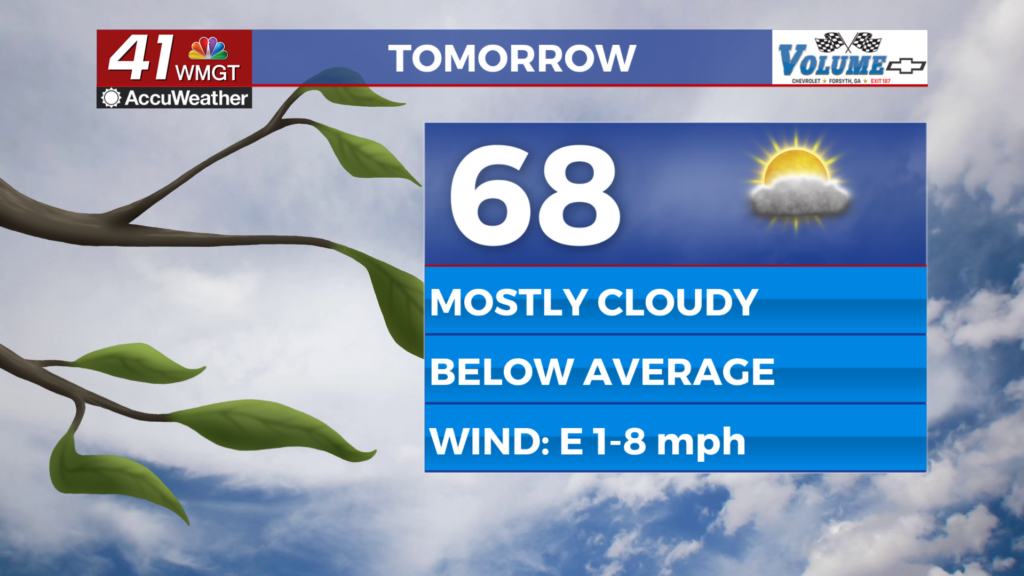
Tomorrow


Saturday will begin rather sunny, however cloud cover will begin to fill in once the lunchtime hours arrive. It shouldn’t be blanket conditions at any point; a 50/50 split of sun and clouds should be the most we see. The European model continues to suggest that there is a chance for a couple of isolated light showers tomorrow afternoon. More than likely we will not see any rain tomorrow afternoon in any part of Middle Georgia. What we will see, however, is plenty of warmth as high temperatures peak in the mid to upper 70s. The winds will almost be a nonfactor tomorrow as they come in at around 5 mph from varying directions.


It won’t be long after the sun sets that all of those clouds that filled in during the afternoon clear out. Clear skies will hang around the rest of the night as the winds come in from the northwest around 5 mph. Temperatures will again be rather chilly by Sunday morning, this time bottoming out in the mid 40s.
Sunday and Beyond


Sunday will continue the sunny Sunday trend we have seen lately. Highs will top off in the low to mid 70s with north-northwest winds blowing in at 5-10 mph. Overnight lows will drop into the mid to upper 40s.

Monday will see a decent amount of sunshine however more clouds will begin to enter the picture, especially once the late afternoon and evening hours draw on. Highs on Monday are expected to be in the lower 80s.
Tuesday is our next good chance for stormy weather. As of now it looks as though storms will arrive during the afternoon hours. Weather models are hinting at the potential for several inches of rain, but by the time Tuesday arrives those numbers will likely drop a respectable amount. Rain is in the forecast from Tuesday afternoon through Thursday morning (with a few breaks in between) for next week at this time.

Follow Meteorologist Aaron Lowery on Facebook (Aaron Lowery 41NBC) and Twitter (@ALowWX) for weather updates throughout the day. Also, you can watch his forecasts Monday through Friday on 41NBC News at Daybreak (6-7 a.m.) and 41Today (11 a.m).