
One more hot day before a brief cool off
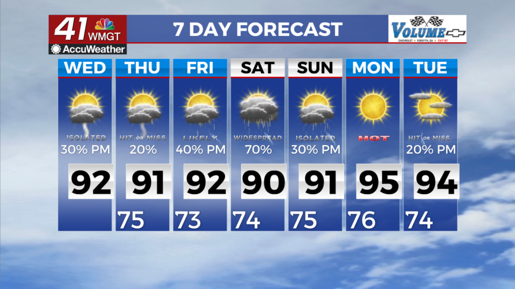
MACON, Georgia (41NBC/WMGT) – Interaction between deep, tropical moisture streaming off of Tropical Storm Bertha and an approaching cold front will drive sensible weather over the next 


few days. Today will mainly be transitional as key features settle in place. An expansive cumulus cloud field has developed across North and Middle Georgia, and isolated to scattered thunderstorms embedded within that banding on the edge of Bertha translates nearly north later this afternoon. Most locales north of I-20 will remain dry. Later today, diurnally enhanced convection will develop into the afternoon, with coverage bolstered by lift supplied from the approaching cold front. Models suggest that redevelopment will occur along the plume of moisture being pulled in atop the stalling front, expected to be oriented roughly parallel to the I-20/I-85 corridor. The potential for training or back building along with high rain rates has prompted the 


Weather Prediction Center to issue a Slight (Level 2 out of 4) Risk for Excessive Rainfall Wednesday through Thursday morning. Current thinking is that flash flooding is unlikely to be widespread, but quick responses are possible in areas that receive multiple deluges, and chances will increase after dark. Due to progressively increasing cloud cover/storm chances, highs today are a tad bit cooler than yesterday, and tomorrow will be just a few degrees cooler still for the northern half of the viewing area. Highs will rise into the upper 80s to mid 90s this afternoon, and into the mid 80s to lower 90s (mid 90s for far southeast Middle Georgia most likely to be unaffected by convection) on Wednesday. Lows remain warm, in the low to mid 70s. For the back half of the work week, a front stalls out across the south, temperatures remain in the upper 80s and lower 90s but rain cooled afternoons will give the northern part of the coverage area a break from the heat. Chances of afternoon thunderstorms will continue into the weekend and thanks to T.S. Bertha’s influx of moisture from the Gulf some of those storms may be extremely efficient rain producers. The concern for flash flooding continues through the weekend.