One more day of sunshine before a cold front brings some rain
MACON, Georgia (41NBC/WMGT) – High pressure is beginning to break down over the Southeastern US.
Today


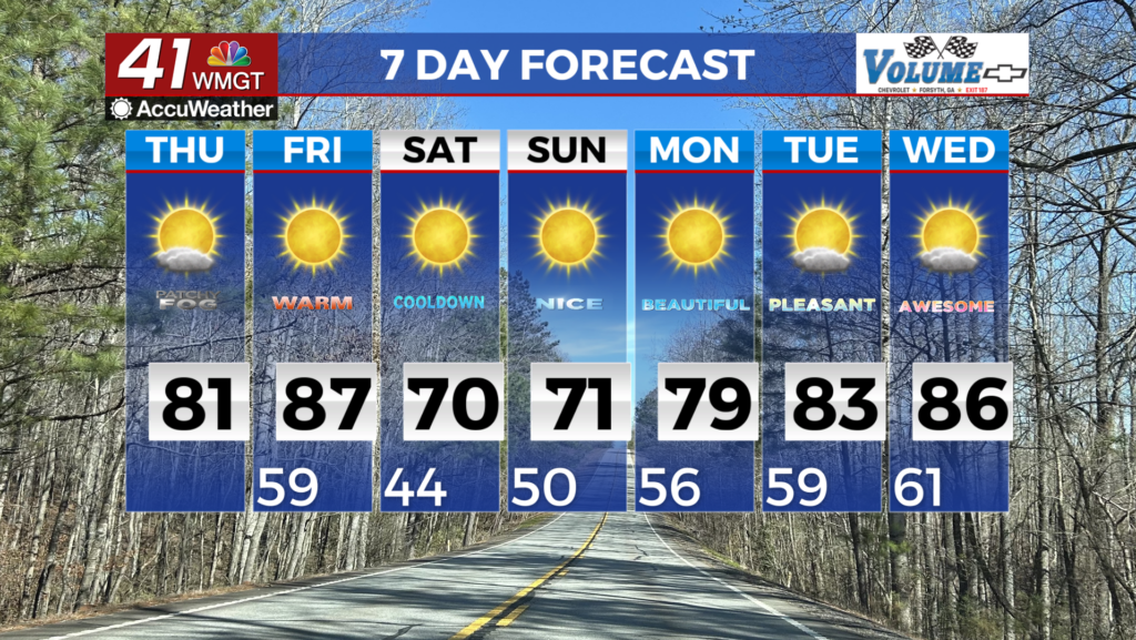
The string of warm mornings for Middle Georgia continued today as the day began with temperatures in the upper 50s and lower 60s. This will be the norm for awhile now as we prepare to head into the summer months. We will again see plenty of heat this afternoon as we will likely see temperatures reach their warmest point so far this year. Forecast highs around Middle Georgia later this afternoon are in mid to upper 80s. A few scattered clouds will fill in during the afternoon hours, but that should be it. Rain is not expected today. Our wind will be steady from the south-southwest today at 5-10 mph.


Overnight tonight the skies should remain mostly clear while the air stays warm and moist. The wind will primarily come in from the south at around 5 mph. The chances for rain tonight are very slim. Low temperatures will bottom out in the mid 60s for most of the region.
Tomorrow


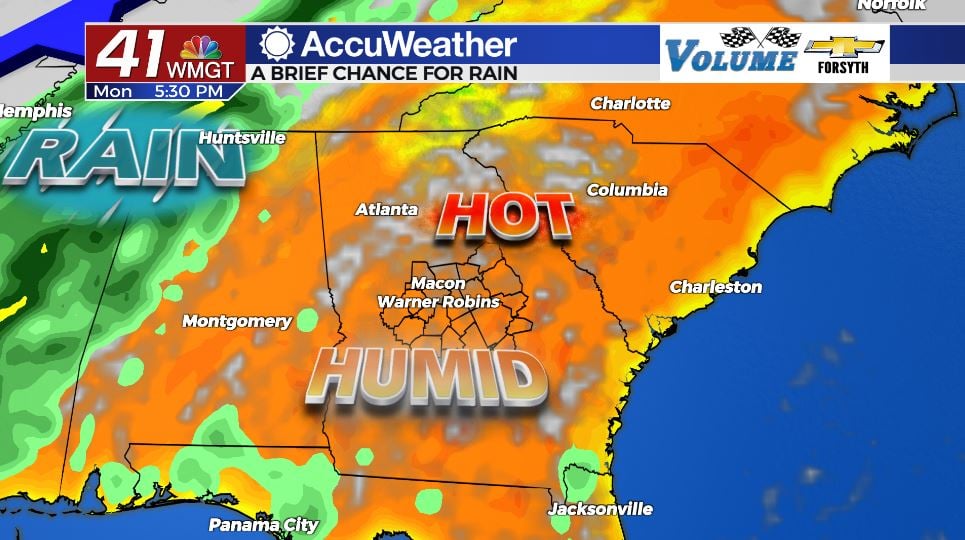
Tomorrow will bring our first rain chance since last Monday morning. The day will begin with a nice sunrise but clouds will begin to fill in during the late morning hours. It will still get rather warm as highs peak primarily in the mid 80s. During the late afternoon hours scattered storms will fire up around the region. The SPC has not identified any risks of severe weather for Middle Georgia tomorrow. Not everybody in the region is guaranteed to see rain either. Winds will blow in from the southwest at 10-15 mph until the front comes through. At that point they will shift towards the northwest.


Overnight a few showers may linger early, but clouds and rain alike will clear out before Wednesday morning. The wind will blow in from the north-northwest at 5-10 mph, replacing the warm and moist air we have seen for the past few days with some cooler, dry air. Overnight lows heading into Wednesday will drop more than 10 degrees from Tuesday morning as they fall into the low to mid 50s.
Wednesday and Beyond


The weather looks pleasant following the passing of the cold front. Wednesday will be warm but not too hot as highs reach the lower 80s around the region under sunny skies. Wind will primarily come in from the north-northeast at 5 mph. Overnight lows will drop into the upper 40s and lower 50s.

Thursday will be slightly warmer as highs return to the low to mid 80s again under sunny skies. Winds will come in primarily from the east-southeast around 5 mph. Overnight lows will drop into the low 50s.
Temperatures will slightly warm again heading into Friday as highs reach the low to mid 80s again. Winds will come in from the south at 5-10 mph as the skies see a few more clouds fill in during the afternoon. Overnight lows will warm up heading into Saturday as they only drop into the mid to upper 50s.

Follow Meteorologist Aaron Lowery on Facebook (Aaron Lowery 41NBC) and Twitter (@ALowWX) for weather updates throughout the day. Also, you can watch his forecasts Monday through Friday on 41NBC News at Daybreak (6-7 a.m.) and 41Today (11 a.m).