

Not as chilly Wednesday
MACON, Georgia (41NBC/WMGT) – Temperatures will return to the 60s Wednesday afternoon around Middle Georgia.
This Evening
It’s been another chilly day around Middle Georgia however it has been overall sunnier than Monday. The biggest difference is the lack of wind, however, as gusts today have largely stayed under 10 mph. It will be another cold night, however as temperatures will still drop down to or just below freezing. The wind will shift to out of the southwest, however, allowing for more warming to begin over the next few days.
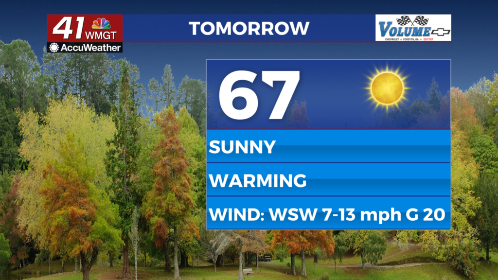
Tomorrow
Another sunny day is likely with below average highs for this time of year, however it will feel rather pleasant after the chilly start to the week. Highs will reach into the mid to upper 60s accompanied by west-southwest winds at 7-14 mph with gusts upwards of 20 mph.


Overnight will be cool but certainly above freezing as lows will drop to around 40 degrees. Wind will shift to out of the west-northwest at 5-10 mph. A few clouds are likely to pass overhead however skies should be mostly clear.
Thursday and Beyond
Conditions will continue to warm Thursday as highs climb into the 70s around the region. Temperatures will stay in the 70s to end the week and through the weekend as overnight lows will gradually continue to increase as well. Rain odds look to be negligible through the next 7 days.

Follow Chief Meteorologist Aaron Lowery on Facebook (Aaron Lowery 41NBC) and X (@ALowWX) for weather updates throughout the day. Also, you can watch his forecasts Monday through Friday on 41NBC News at 4, 5, 5:30, 6, and 11 p.m.