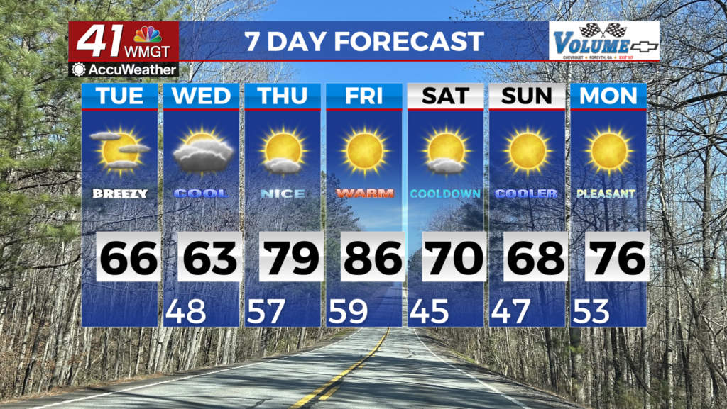
Nicer weather returns Wednesday
MACON, Georgia (41NBC/WMGT) – Sunnier but cooler conditions will take back over Middle Georgia following today’s cold front and storms.
The Rest of the Evening


It will be rather windy around Middle Georgia this evening and tonight as cloud cover slowly breaks up. A wind advisory is in effect for Middle Georgia until 1:00 AM tonight/tomorrow morning. Low temperatures will be in the mid 30s for most of the region, however winds of 10-20 mph from the west-southwest (gusting to over 30 mph) will bring in chills that dip into the mid 20s. Wind will steadily calm a bit over the later parts of the night.
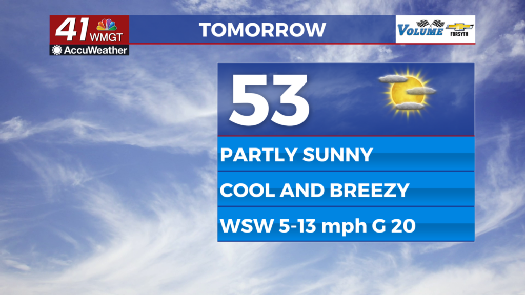
Tomorrow


There should be a good amount of sun for Middle Georgians to get outdoors. Some cirrus clouds will likely pass through during the afternoon. Highs will reach the lower 50s for most of the region with winds from the west-southwest continuing to come in at about 10-15 mph. Gusts could reach over 20 mph throughout the afternoon.


Overnight will be mostly clear with low temperatures around freezing. Southwest winds will blow at about 5-10 mph.
Thursday and Beyond


Thursday will be similar to tomorrow in terms of cloud cover, however winds will be a lot calmer and highs will likely reach into the lower 60s for much of the region. Cloud cover will return overnight Thursday with rain likely to arrive after midnight. Another cold front Friday will likely bring another round of strong storms to the region. Confidence for the timing of this next front is low right now, but don’t be surprised if it is similar to what we saw earlier today. The weekend should see plenty of sun accompanied by seasonal temperatures.

Follow Meteorologist Aaron Lowery on Facebook (Aaron Lowery 41NBC) and Twitter (@ALowWX) for weather updates throughout the day. Also, you can watch his forecasts Monday through Friday on 41NBC News at 4, 5, 5:30, 6, and 11 PM.