


Mugginess and heat climb this weekend
MACON, Georgia (41NBC/WMGT) – Wind out of the south will continue to bring warm and moist air to Middle Georgia this weekend ahead of rain and storms.
This Evening
A very warm Friday afternoon will stay pretty warm even after the sunset. Wind from the south-southeast will flow in at 5-12 mph, gusting upwards of 17 mph (especially by tomorrow morning). Cloud cover will increase through the overnight hours. Low temperatures will be 10 or more degrees above average as they only fall into the mid to upper 50s. The warmest spots may stay above 60 degrees.
Tomorrow
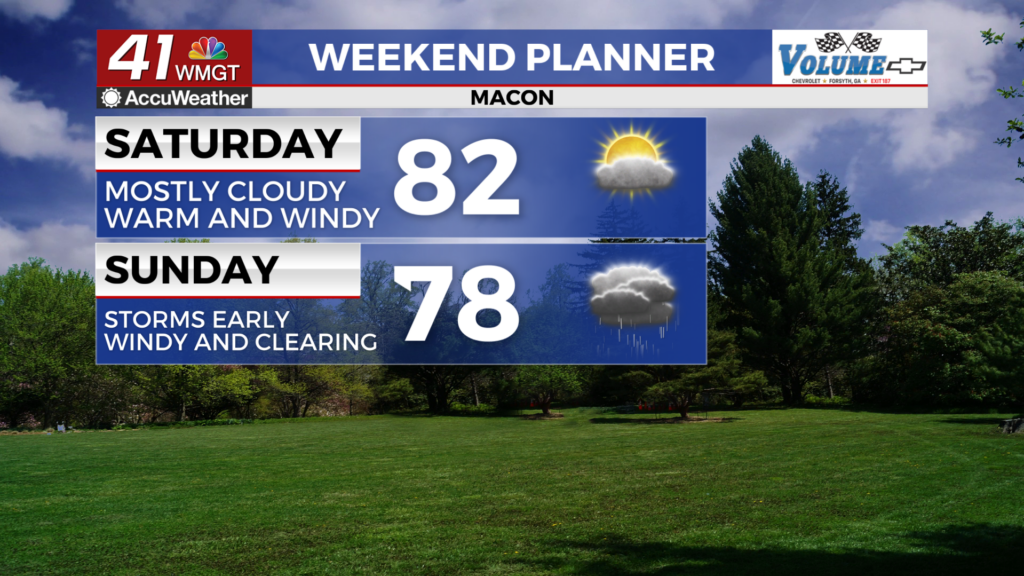
Saturday will be partly to mostly cloudy across the region with plenty of heat as highs climb into the 80s around Middle Georgia. Wind will continue to flow from the south-southeast at 5-12 mph, gusting as high as 20 mph. A few isolated showers will be possible at any point of the day.


Overnight expect mostly cloudy skies with low temperatures that are 15+ degrees above average, mainly falling into the lower 60s. Wind will continue from the south at 5-11 mph with gusts ranging from 15-20 mph. A couple of showers will remain possible.
Sunday and Beyond
Sunday will be a bit cooler but only because of more clouds and higher rain odds. Most of the region will see either rain or some showers. A rumble of thunder cannot be ruled out. Highs will still be warm as they reach the upper 70s. Wind will be out of the south at 6-13 mph with gusts pushing 25 mph. Rain should taper off more into the evening, however a couple of spotty showers will remain possible overnight.


Monday could see severe storms as a cold front moves in from the west. Unlike recent severe storms threats, this one will likely be more in the afternoon instead of overnight. While this is good news in regards to avoiding an overnight tornado threat, warmer temperatures in the afternoon could be more favorable for overall severe development.

Follow Chief Meteorologist Aaron Lowery on Facebook (Aaron Lowery 41NBC) and Twitter (@ALowWX) for weather updates throughout the day. Also, you can watch his forecasts Monday through Friday on 41NBC News at 4, 5, 5:30, 6, and 11 p.m.
