More storms expected over the weekend
MACON, Georgia (41NBC/WMGT) – Cloud cover will return to Middle Georgia this evening ahead of a weekend storm system.
This Evening


Valentine’s Day has been mostly sunny across Middle Georgia. This has been welcomed by many after a mostly cloudy week. The sunshine is short lived, however, as clouds are returning this evening. Any lovebirds going out for the holiday should bring an extra layer due to the cool temperatures, however any rain activity should hold off until well after sunset. A couple of showers will be possible overnight and into tomorrow morning. Expect low temperatures to be in the 40s across the region as the wind flows from the east at 5-10 mph.
Tomorrow and Sunday Morning


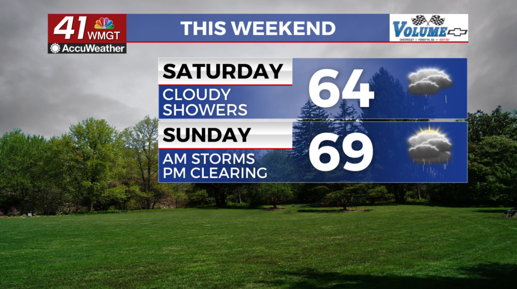
Saturday will be mostly cloudy to overcast around Middle Georgia as high temperatures will likely range from the lower 60s into the mid 70s. Wind for most of the region will flow from the south at about 8-15 mph, however the northern counties will likely see calmer northeasterly winds as another cold air wedge sets up. Isolated to scattered showers will be possible over the back half of the day.


Overnight will be warm thanks to the region falling in the warm sector of the storm system ahead of the cold front. Expect lows in the upper 50s and 60s across the region. Wind will be out of the south-southwest at 10-25 mph, peaking just ahead of storm arrival. The strongest gusts could push over 40 mph.


Storms should arrive around 5-6 am Sunday morning. As of now a Level 1 “Marginal” threat for severe weather includes basically the whole region. This risk may increase if temperatures Saturday end up warmer than forecast. The primary threat will be straight line winds, however small hail and a brief tornado cannot 100% be ruled out. These storms should be clearing the region at around 9-10 am Sunday morning.
The Rest of Sunday


Clouds will work to clear out following the morning storms as the wind works to shift out of the northwest through the remainder of the afternoon. Expect sustained speeds to range from 10-20 mph with gusts exceeding 30 mph for much of the day. There should be a healthy dose of sunshine by the time the sun sets for the northern half of the region. Sunny skies will carry into Monday of the new week as well.

Follow Chief Meteorologist Aaron Lowery on Facebook (Aaron Lowery 41NBC) and Twitter (@ALowWX) for weather updates throughout the day. Also, you can watch his forecasts Monday through Friday on 41NBC News at 4, 5, 5:30, 6, and 11 p.m.


