


More heat and humidity Thursday
MACON, Georgia (41NBC/WMGT) – Unseasonably warm and humid conditions will continue Thursday around the Peach State.
This Evening
A very warm and partly cloudy afternoon will become a warm and muggy night across Middle Georgia. It will be breezier than last night with wind expected from the south-southeast at 6-12 mph. Gusts will likely range 15-20 mph. This could limit fog potential leading up to tomorrow morning despite very warm and muggy conditions. Low temperatures and dew points will both be in the mid to upper 60s leading up to Thursday morning. A stray shower could be possible early tonight, however rain is not expected during the overnight hours as a whole.
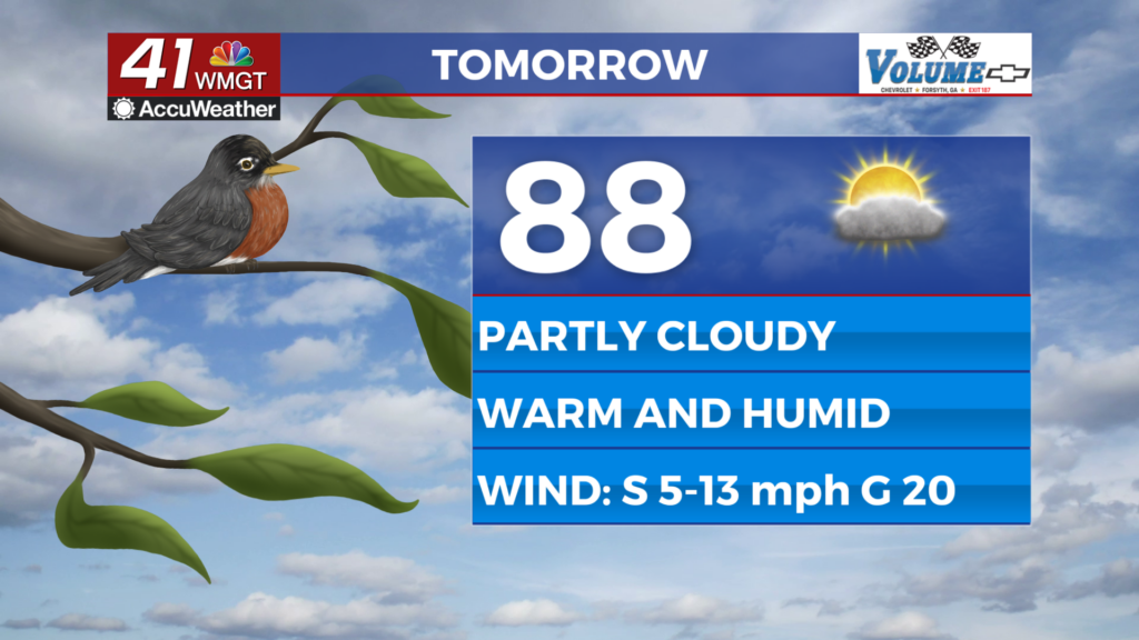
Tomorrow
It will be partly cloudy again across Middle Georgia as highs push the upper 80s. The warmest spots will likely eclipse the 90 degree mark. Heat indexes will likely reach the 90s for most of if not the entire region. A couple of stray showers or perhaps a thunderstorm will be possible, however overall rain odds will remain on the backburner. Wind will continue from the south at 5-13 mph with gusts hanging around 20 mph.


It will be another warm and muggy night under partly cloudy skies. Wind will be calmer from the south at around 5 mph, so fog odds will be higher leading up to Friday morning. No rain is expected overnight.
Friday and Beyond
Hot and humid conditions will continue through Saturday before rain odds begin to climb late Sunday. Storms are likely Sunday and Monday as a slow moving cold front arrives. Severe weather could be possible as this frontal passage occurs. Temperatures will dip below average following the passage of said cold front.

Follow Chief Meteorologist Aaron Lowery on Facebook (Aaron Lowery 41NBC) and Twitter (@ALowWX) for weather updates throughout the day. Also, you can watch his forecasts Monday through Friday on 41NBC News at 4, 5, 5:30, 6, and 11 p.m.
