


More clouds Wednesday
MACON, Georgia (41NBC/WMGT) – A stalled out frontal system will increase cloud cover across Middle Georgia tonight and Wednesday.
This Evening
A sunny and warm afternoon will become a warm and muggy night as cloud cover thickens through the night. Wind will flow from the north-northwest around 5 mph. Fog is once again likely around the region heading into the start of Wednesday. Temperatures will valley in the low to mid 50s across the region.
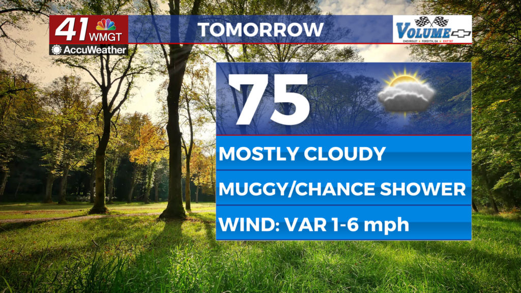
Tomorrow
A slow moving cold front coming from the north will stall out, keeping excess moisture and cloud cover in the area and for a day make the wind light and variable, primarily out of the northeast. Highs will not be as warm as Tuesday thanks to the added clouds, only reaching the mid to upper 70s. A few isolated showers will be possible over the back half of the day.


Overnight a couple showers will also be possible, especially early on. Temperatures will only drop into the mid to upper 50s as the wind flows from the south at 7 mph or under. Fog will once again be possible at the surface under mostly cloudy skies.
Thursday and Beyond
Partly cloudy and breezy conditions are likely Thursday with highs reaching the upper 70s and lower 70s. That wind will flow from the southwest at 7-15 mph, gusting between 20-25 mph in the afternoon. A couple of spotty showers will also be possible in the evening. Shower odds will climb more on Friday with partly to mostly cloudy skies and unseasonably warm temperatures carrying into the weekend.

Follow Chief Meteorologist Aaron Lowery on Facebook (Aaron Lowery 41NBC) and Twitter (@ALowWX) for weather updates throughout the day. Also, you can watch his forecasts Monday through Friday on 41NBC News at 4, 5, 5:30, 6, and 11 p.m.
