More clouds Friday
MACON, Georgia (41NBC/WMGT) – Cloud cover and humidity will begin to increase ahead of the weekend.
This Evening


Mostly sunny skies will become partly cloudy overnight tonight as wind from the southeast rolls in at around 5 mph. Fire danger remains high with a Fire Danger Statement in effect until 8 PM EDT due to extremely low relative humidity. Expect low temperatures in the mid to upper 40s across the region.
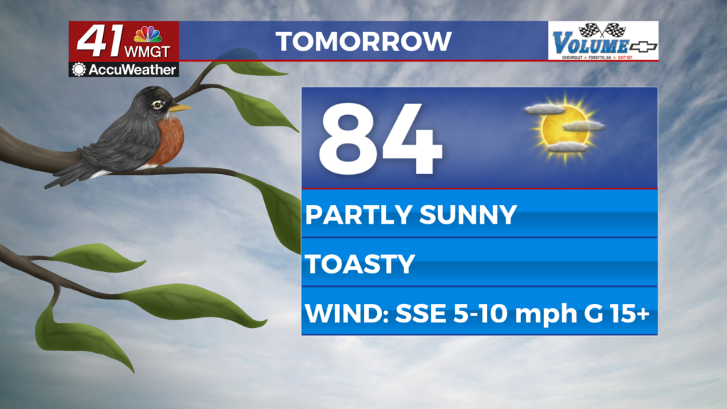
Tomorrow


Friday will be warm and partly sunny with plenty of high clouds expected throughout the day. Highs will reach the low to mid 80s around the region. Wind will flow from the south-southeast at 5-10 mph, gusting upwards of 15 mph.


Overnight will be cloudier with low temperatures jumping up into the mid 50s around Middle Georgia. Wind will flow from the south-southeast at 5-12 mph with gusts pushing 20 mph.
This Weekend and Beyond


Partly cloudy skies are likely Saturday with the chance for a few isolated showers. Sunday’s rain odds will be more widespread. Monday could see some severe storms as another cold front arrives.

Follow Chief Meteorologist Aaron Lowery on Facebook (Aaron Lowery 41NBC) and Twitter (@ALowWX) for weather updates throughout the day. Also, you can watch his forecasts Monday through Friday on 41NBC News at 4, 5, 5:30, 6, and 11 p.m.

