Limited rain chances Thursday
MACON, Georgia (41NBC/WMGT) – Rain odds on Thursday around Middle Georgia will be isolated despite an incoming cold front.
This Evening and Overnight


It’s been another warm and sunny afternoon across Middle Georgia as temperatures soared into the upper 70s for most of the region. The warmest locations reached into the lower 80s. Wind will remain out of the southwest through this evening and into tonight, gradually getting stronger leading into Thursday morning. Gusts should be around 15 mph by sunrise with sustained speeds ranging from 5-10 mph. Low temperatures will fall into the low to mid 40s. Skies overhead should largely remain clear.
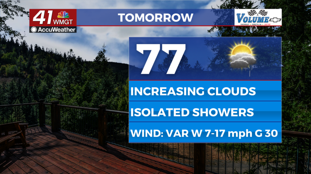
Tomorrow


Mostly clear skies are expected around sunrise, however clouds will fill in during the late morning and lunchtime hours. Thanks to lower than expected dew points the overall rain odds around Middle Georgia will be quite low. A few isolated showers and perhaps a rumble of thunder will be possible, but much of the region will not see any rain. Highs will reach into the upper 70s again for most of the region with wind shifting from the southwest to the northwest throughout the day. Expect sustained speeds to range from 5-20 mph with gusts ranging from 20-30 mph.


Skies will clear out quickly during the late evening as the cold front clears the region. Expect a blustery night with winds from the northwest ranging from 5-15 mph, gusting to around 20-25 mph. Lows will drop into the lower 40s with the coldest spots potentially cracking into the upper 30s.
Friday and Beyond


Friday will be a bit cooler as a result of the cold front on Thursday. Highs will reach the upper 60s and lower 70s with wind from the west blowing in at 5-10 mph, gusting to around 15 mph throughout the afternoon. Skies overhead should be completely clear. Warming will occur Saturday ahead of another cold front that will make things breezy throughout the afternoon.
Sunday will be a bit cooler, however, as high temperatures only reach the mid 60s following several days in the 70s.

Follow Chief Meteorologist Aaron Lowery on Facebook (Aaron Lowery 41NBC) and Twitter (@ALowWX) for weather updates throughout the day. Also, you can watch his forecasts Monday through Friday on 41NBC News at 4, 5, 5:30, 6, and 11 p.m.


