Isolated storms possible as temperatures stay near average
MACON, Georgia (41NBC/WGMT) – Isolated storms will be possible again Wednesday afternoon and evening.
This Evening


It’s been another pretty hot day around Middle Georgia however the temperatures have again been near or even below average for this time of year. However rain chances seem to be higher today than yesterday as isolated showers could become a bit more widespread through the evening. Overhead skies should be clear, especially after midnight. Overnight lows will be around 70 degrees with a few spots going below that mark. Wind will be light from the northeast around 5 mph.
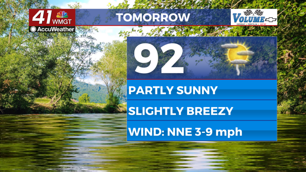
Tomorrow


Wednesday should also be pretty nice with highs in the low to mid 90s accompanied by light breezes from the north-northeast. Gusts could push as high as 20 mph as Hurricane Erin churns off the shore over the Atlantic Ocean. Real feels (heat indexes) will again hover around 100 degrees. As for afternoon storms around 1/3 of the region should see them. Nothing severe is expected.


Overnight will be mostly clear with lows in the lower 70s for most of the region. One or two spots may still drop below 70 degrees. Wind will shift more towards the north-northwest leading up to Thursday morning.
Thursday and Beyond


Rain odds seem to be climbing over the latter half of the day Thursday and Friday will see widespread storm activity as a weak front approaches from the north. Rain odds will remain elevated through the region with temperatures only climbing into the low to mid 80s. More sunshine is likely early next week as temperatures stay below average for this time of year.
The Tropics


Erin has weakened more as it has largely stalled out north of The Bahamas and Turks and Caicos Islands. Hazardous impacts are still expected along the Outer Banks of North Carolina.

Aside from Erin there are two other areas to monitor in the Atlantic: One with 60% odds to become a depression in the next 7 days and the other with 30% odds to become a depression in the next 7 days. The next name in line for the 2025 Atlantic Hurricane Season is Fernand.

Follow Chief Meteorologist Aaron Lowery on Facebook (Aaron Lowery 41NBC) and Twitter (@ALowWX) for weather updates throughout the day. Also, you can watch his forecasts Monday through Friday on 41NBC News at 4, 5, 5:30, 6, and 11 p.m.


