


Incoming cold front to bring more storm chances to end the week
MACON, Georgia (41NBC/WMGT) – A weak cold front coming from the north will spur on storms Friday evening as well as Saturday.
This Evening
It’s been a hot one around Middle Georgia today with many highs reaching the lower 90s and most of the heat indexes eclipsing 100 degrees. Rain has been hard to come by and it should stay that way through the evening and into tonight. Skies will be partly cloudy to mostly clear around the region rolling into Friday morning. Expect most of the low temperatures to be in the mid to upper 70s across Middle Georgia. Fog will be possible as well as the wind will be light from the west-northwest.
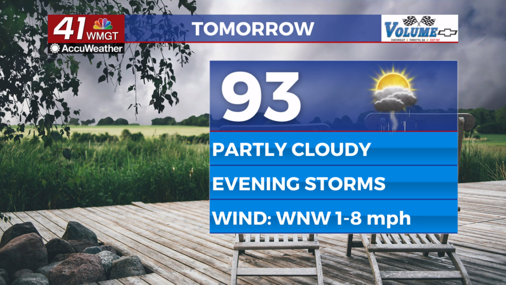
Tomorrow
As hot as today was tomorrow will be even hotter as temperatures should be largely around average for this time of year. Some spots may even be a bit above the average. Highs will reach into the mid 90s with the hottest spots pushing the upper 90s. Real feels should eclipse 100 degrees across Middle Georgia. The wind will help very little as it flows from the west-northwest around 5 mph.


Rain chances will increase in the late afternoon and especially the evening. While severe weather is not expected the most organized storms could have relatively strong wind gusts. High school football will largely be getting underway around the region as well tomorrow night, and anyone attending would be wise to bring their rain gear.


Overnight a few storms may linger as skies will be partly to mostly cloudy leading up to Saturday morning. Low temperatures will again largely be in the mid 70s around the region, or around 2-4 degrees over the average. Wind will be light and generally out of the north.
This Weekend
Saturday will be partly cloudy with another round of scattered storms likely through the afternoon and evening as the cold front stalls out a bit to the south. Highs will largely be in the lower 90s however a few upper 80s will be possible. Sunday on the other hand will feature a bit more sunshine as well as highs in the upper 80s and lower 90s, or a couple degrees cooler than Saturday. Rain odds on Sunday will also be a good bit lower.
Watching the Tropics
Tropical Storm Erin continues to strengthen as it meanders west in the Atlantic. As of now it’s a Tropical Storm with 60 mph winds, however it may become a hurricane overnight tonight/early tomorrow. A projected turn north is expected over the weekend, and the sooner that happens the better for the East Coast of the United States. Along with Erin there is an area of interest in the Gulf that could impact Northern Mexico/Southern Texas. This currently has 40% odds to become a depression over the next 48 hours.

Follow Chief Meteorologist Aaron Lowery on Facebook (Aaron Lowery 41NBC) and Twitter (@ALowWX) for weather updates throughout the day. Also, you can watch his forecasts Monday through Friday on 41NBC News at 4, 5, 5:30, 6, and 11 p.m.

