Incoming cold front could bring showers tonight
MACON, Georgia (41NBC/WMGT) –
.
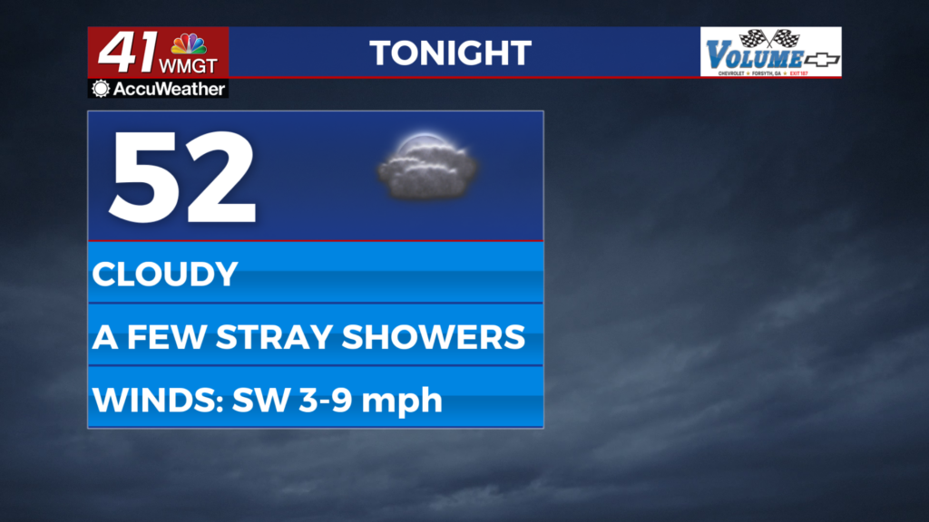
This Evening


It’s again been mostly cloudy around Middle Georgia today however the sun has emerged a bit more in the latter part of the day. Expect clouds to return through the evening along with the possibility for a few small showers. The wind will flow from the southwest at 5-10 mph with gusts reaching as high as 20 mph as the front passes. No thunderstorms are expected. Low temperatures will be in the low to mid 50s.
Tomorrow


Another cloudy start is likely around the region however by lunchtime more sunshine should be taking over. It likely will not completely clear out, however, as scattered clouds will stick around through the afternoon and evening. High temperatures will reach the mid to upper 70s accompanied by west-southwest winds at 5-10 mph. Gusts should reach to around 15 mph through the afternoon.


Overnight will be mostly cloudy once again with a slim chance for a shower. Temperatures should be a few degrees cooler than Tuesday night as lows will hover around 50 degrees. The wind will be light and variable and fog will be possible leading into Thursday morning.
Thursday and Beyond


Expect the end of the week to continue the mostly cloudy and warm trend as the humidity will climb leading into the weekend. A 2nd cold front will bring much better storm chances with some showers possible Friday and the aforementioned storms likely sometime Saturday. More will become clear about hazards with these storms as the week progresses. As of now the SPC has not highlighted anything for Georgia, however that Level 2 “Slight” risk for Mississippi, Louisiana, Tennessee, and parts of Arkansas/Alabama remains in effect for Friday afternoon/evening.

Follow Chief Meteorologist Aaron Lowery on Facebook (Aaron Lowery 41NBC) and X (@ALowWX) for weather updates throughout the day. Also, you can watch his forecasts Monday through Friday on 41NBC News at 4, 5, 5:30, 6, and 11 p.m.