Hurricane Helene to bring dangerous conditions to Middle Georgia Thursday
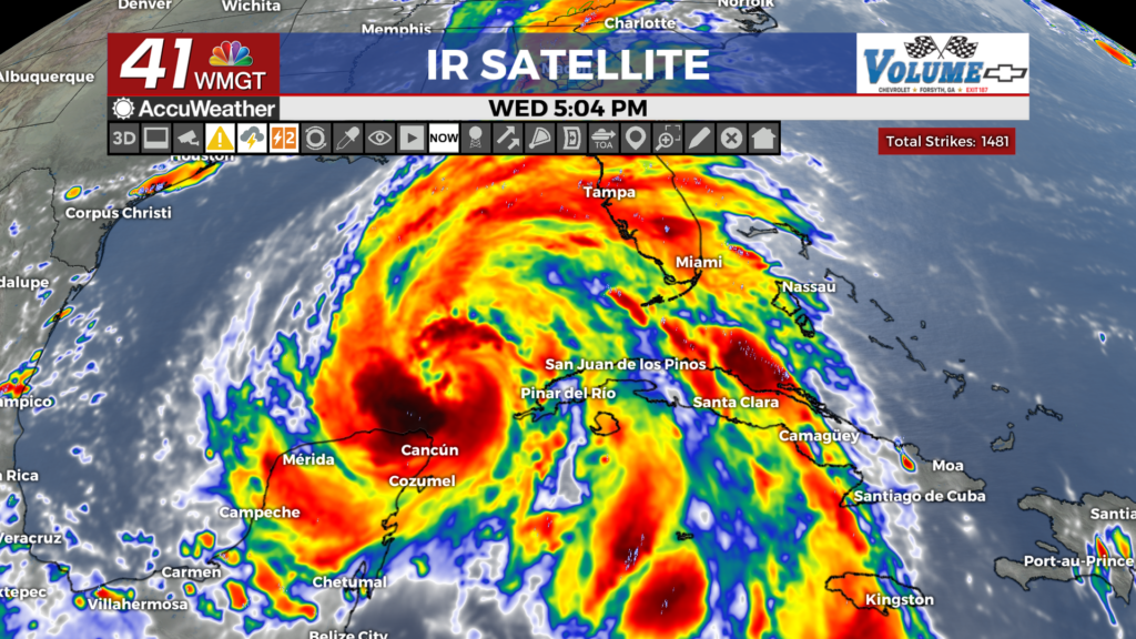
MACON, Georgia (41NBC/WMGT) – Hurricane Helene is expected to be a major hurricane at landfall and could bring hurricane conditions to parts of Middle Georgia tomorrow night.
This Evening


Cloud cover will continue to fill in around Middle Georgia ahead of a cold front that has brought plenty of rain already to the northern part of the state. Some heavy rain will be possible late this evening and overnight courtesy of that front. This is obviously not good news ahead of a hurricane that will bring plenty of rain on its own, as well as powerful winds. A few strong wind gusts will be possible with storms this evening and tonight. A Level 1 “Marginal” risk for severe weather includes parts of Middle Georgia to account for this.


Aside from rain tonight the wind will be breezy from the south-southeast at 5-15 mph. Gusts could push over 20 mph at times. Low temperatures will again hover around the 70 degree mark.
Tomorrow


Skies will be cloudy and rain will be widespread throughout the day. While much of it should be light, heavier waves will be likely here and there. Additionally, wind will gradually get stronger through the day as Helene nears landfall. Severe activity could be possible in the evening as the northeastern quadrant of the storm approaches. Brief spin-up tornadoes will be the main threat, and a Level 2 “Slight” risk for severe weather includes the southeastern counties of Middle Georgia. Much of the region will be under a Level 1 “Marginal” threat.


Overnight is where the worst will occur. As the eye of Helene approaches some of the southern counties may see hurricane force winds with the northern counties seeing strong end tropical storm winds. A hurricane warning is in effect for the southwestern counties of the region with a tropical storm warning just to the north, including locations such as Macon and Warner Robins. Given the saturated conditions of the ground from the rain Wednesday night, this will make for trees to easily blow over, leading to widespread power outages. Prep should be made ASAP including items like flashlights, charging banks, water bottles, and non-perishable foods. The worst should move out of the region heading into Friday morning.

Follow Meteorologist Aaron Lowery on Facebook (Aaron Lowery 41NBC) and Twitter (@ALowWX) for weather updates throughout the day. Also, you can watch his forecasts Monday through Friday on 41NBC News at 4, 5, 5:30, 6, and 11 p.m.