Heat and humidity rising over the weekend
MACON, Georgia (41NBC/WMGT) – A summerlike pattern will begin to take over the Peach State this weekend and into next week.
Tonight


Mostly cloudy skies will stick with Middle Georgia overnight along with the possibility for a couple of small showers. Winds will generally blow in from the east at around 5 mph. Temperatures will bottom out in the upper 50s and lower 60s. Patchy fog will be possible overnight and into tomorrow morning thanks to today’s rain and relatively calm winds.
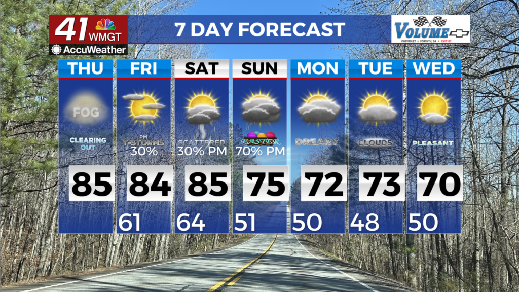
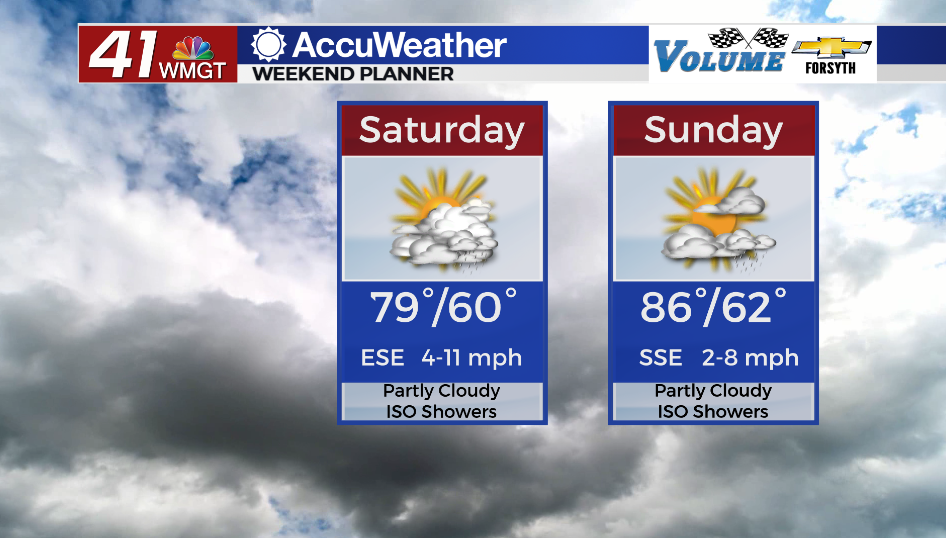
Saturday


Partly to mostly cloudy skies will hang with Middle Georgia throughout the day. A few isolated showers are likely throughout the afternoon and evening. Winds will generally blow in from the east-southeast at about 5-15 mph. High temperatures will reach the upper 70s and lower 80s during the afternoon.


Overnight some cloud cover may clear initially, however it will return ahead of the sunrise on Sunday. Temperatures will largely bottom out in the lower 60s with ambient winds out of the southeast at around 5 mph. Some fog will be possible Sunday morning.
Sunday


What will begin as a cloudy morning will give way to partly sunny skies in the afternoon. Temperatures will climb into the mid to upper 80s around Middle Georgia with ambient winds around 5 mph out of the south-southeast. A couple of spotty showers or storms will be possible in the afternoon and evening.
Overnight cloud cover will return, especially after midnight. Temperatures will bottom out in the low to mid 60s with ambient winds out of the south-southeast around 5 mph.

Follow Meteorologist Aaron Lowery on Facebook (Aaron Lowery 41NBC) and Twitter (@ALowWX) for weather updates throughout the day. Also, you can watch his forecasts Monday through Friday on 41NBC News at Daybreak (5-7 a.m.) and 41Today (11 a.m).