

Heat advisories are out for Middle Georgia today
MACON, Georgia (41NBC/WMGT) – Feels like temperatures around Middle Georgia this afternoon will be in the triple digits.
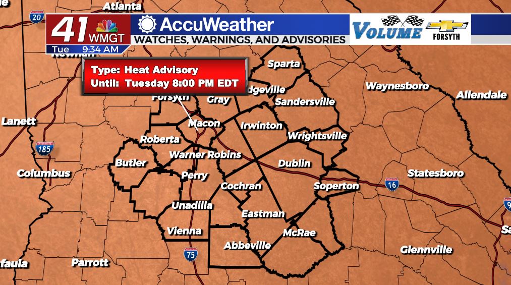
Today
The heat will be unrelenting as we go through the day today, and our rain chances are no where near as high as they were initially thought rolling into today. Heat advisories are in effect until 8:00 PM EDT today. We will see actual high temperatures in the upper 90s and lower 100s, however heat indices will be pushing 110 around the region with some spots getting over it. We should, however, still see a good amount of cloud cover later this afternoon in the form of cloud fields. A few upper level clouds will also be present.


In terms of our storm chances today, they have dropped monumentally. Models were calling for widespread storms around Middle Georgia throughout the afternoon and evening today as recently as this morning, but now it’s looking more like a few isolated showers in the afternoon before a few more organized storms move in during the early overnight hours. These more organized storms are more likely to impact our southern counties, but they could impact anywhere in the region. As of right now a Level 1 Marginal threat has been issued for the whole region ahead of storms this evening. The primary risk is strong wind gusts, but some of the storms could have some small to medium hail.


Once the early overnight storms subside, we will be left with warm, sticky, and mostly cloud conditions. A good bit of those clouds should clear ahead of tomorrow morning. Low temperatures will be in the mid to upper 70s with calm winds.
Tomorrow
Tomorrow is already looking like a carbon copy of today, although models are currently hinting at widespread storms in the afternoon. If that follows the same pattern as yesterday, they will end up being isolated and nothing more, much like today. Highs will be in the upper 90s and lower 100s once again as cloud fields fill the sky in the afternoon.


Overnight lows will drop into the mid to upper 70s with calm winds.
Thursday and Beyond
The extreme heat will continue through the work week and into the weekend, however models are hinting at the possibility of a slight reduction in humidity for Father’s Day weekend as well as a drop in high temperatures back into the low to mid 90s. With a drier air mass moving in over the weekend, rain chances will also drop, allowing for grilling without issues for the holiday (pay attention to local authorities in regards to burn rules for any drought conditions).

Follow Meteorologist Aaron Lowery on Facebook (Aaron Lowery 41NBC) and Twitter (@ALowWX) for weather updates throughout the day. Also, you can watch his forecasts Monday through Friday on 41NBC News at Daybreak (6-7 a.m.) and 41Today (11 a.m).