


Friday to see foggy morning followed by afternoon storms
MACON, Georgia (41NBC/WMGT) – More scattered thunderstorms are expected Friday afternoon around Middle Georgia.
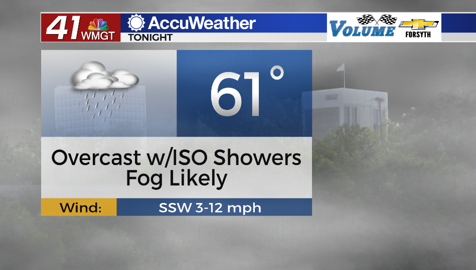
Tonight
Overcast conditions should stick around Middle Georgia throughout the night tonight. A few isolated showers will also be possible. The excess moisture from rain in the afternoon and evening combined with gentle winds will likely lead to the development of fog across much of Middle Georgia after midnight. Some areas may see very dense fog. This will likely stick around into Friday morning. Temperatures overnight will bottom out in the lower 60s.
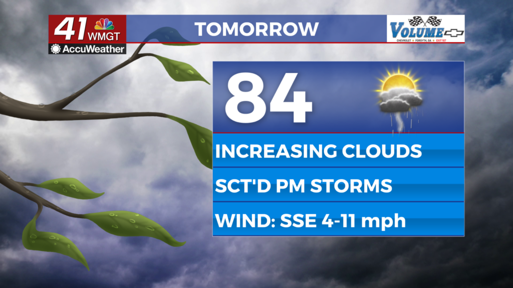
Tomorrow
Cloud cover will hang around into the lunchtime hours across Middle Georgia tomorrow. Fog could also stick around into the mid morning in some spots. Temperatures will eventually warm into the lower 80s once cloud cover breaks heading into the afternoon. A round of scattered storms is likely during the afternoon and evening hours. A Level 1 “Marginal” risk for severe weather has been issued by the SPC to account for this. Risks will largely be wind gusts and some small hail.


Tomorrow night the rain activity should stop, however an isolated shower or two will be possible early on. Clear conditions are expected overnight however the moisture content in the region will remain high heading into Saturday morning. Temperatures will only bottom out into the upper 50s and lower 60s with ambient winds generally out of the west at around 5 mph.
The Weekend
Saturday will start on a relatively sunny note before cloud cover fills in throughout the day. While rain is not expected while the sun is out, overnight storms are likely to move in with a warm front ahead of Sunday morning. It is too far out at this time to know if there will be a chance for severe weather here. Temperatures rolling into Sunday morning will be in the lower 60s, and dew points are expected to be about the same thanks to the warm front.


Sunday will see storms through the first half of the day as a cold front associated with a new low riding just north of the Gulf of Mexico advances northeast. It is too far out at this time to know if there will be a severe threat with these storms, however the forecast for Sunday morning is a cloudy one (rainy too with the warm front passing). This could help to inhibit some storm activity, but some stronger storms could still be possible.
Sunnier conditions will return on Monday and should hang around for at least the first parts of next week.

Follow Meteorologist Aaron Lowery on Facebook (Aaron Lowery 41NBC) and Twitter (@ALowWX) for weather updates throughout the day. Also, you can watch his forecasts Monday through Friday on 41NBC News at Daybreak (5-7 a.m.) and 41Today (11 a.m).

