Fire threats are up around Middle Georgia as dry conditions persist
MACON, Georgia (41NBC/WMGT) – Abnormally low humidity and a lack of recent rainfall have led to an elevated risk for wildfires in Middle Georgia this afternoon.
Today


It was the coldest morning of the week in Middle Georgia as all but a pair of locations started the day below 50 degrees. We didn’t stay cool long, however, as plenty of heat is anticipated once again this afternoon. Highs will reach the low 80s across the region later on today as the wind comes in from the east-southeast at 5-10 mph. Gusts could reach speeds of 15 mph. Cloud cover will remain at a minimum once again, and the forecast UV index for today is 10, so sunblock is a necessity for anyone with extensive outdoor plans.


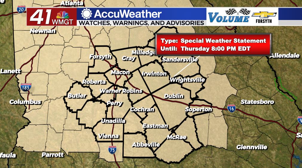
In terms of the fire threat today, the NWS has again issued a Special Weather Statement for favorable fire conditions for Middle Georgia until 8:00 pm EDT. The main concern for this afternoon is humidity values below 20% across the board. The wind luckily isn’t going to be too crazy, but a 15 mph gust could still spread a fire provided there is a spark. Anyone with plans to burn anything should contact local authorities before they do so.


Overnight the skies will remain mostly clear until we approach Friday morning. A few clouds will fill in ahead of the sunrise, however it will not be blanket conditions. The winds will shift to the southeast early, still blowing at 5-10 mph. The combination of added cloud cover and southeasterly winds will warm our lows from the mid to upper 40s into the lower 50s. There may be one or two locations that sees a low below 50 degrees tonight.
Tomorrow


Fire threats are likely to persist into tomorrow even with the southeasterly flow, as it takes a day or two for that humidity to rise back up. Winds tomorrow will primarily come in from the south-southeast at 5-10 mph. Gusts could again reach 15-20 mph. Highs will be in the low to mid 80s across the board. Scattered clouds will develop in the afternoon, and some of them will spawn a few showers or small thunderstorms during the late afternoon/evening hours. No severe weather is expected.


More cloud cover will develop overnight leading into Saturday, however it still should not be blanket conditions. Lows will jump into the upper 50s in response to south-southeasterly winds at 7-12 mph. Gusts could still reach 20+ mph at times during the night as well.
The Weekend and Beyond

Saturday will begin sunny however plenty of cloud cover is anticipated to develop in the afternoon. Isolated thunderstorms will also develop around the region during the afternoon thanks to surface heating instability. These storms will taper off in the evening. Highs will be in the mid 80s with lows in the upper 50s and lower 60s.

Sunday will see even more cloud cover than Saturday as more widespread storms develop in the late afternoon/evening. Highs will be in the mid to upper 80s with lows in the lower 60s.
Monday will be hot as highs soar into the upper 80s as southerly winds persist. There will be plenty of cloud cover in the afternoon as more scattered storms develop during the heat of the day. Lows will drop into the low 60s.

Follow Meteorologist Aaron Lowery on Facebook (Aaron Lowery 41NBC) and Twitter (@ALowWX) for weather updates throughout the day. Also, you can watch his forecasts Monday through Friday on 41NBC News at Daybreak (6-7 a.m.) and 41Today (11 a.m).