Feeling more like Fall today
MACON, Georgia (41NBC/WMGT) – The main story will be the strong wedge setting up across the region ushering in the long awaited first taste of Fall. Dewpoints are dropping into the 60s and 


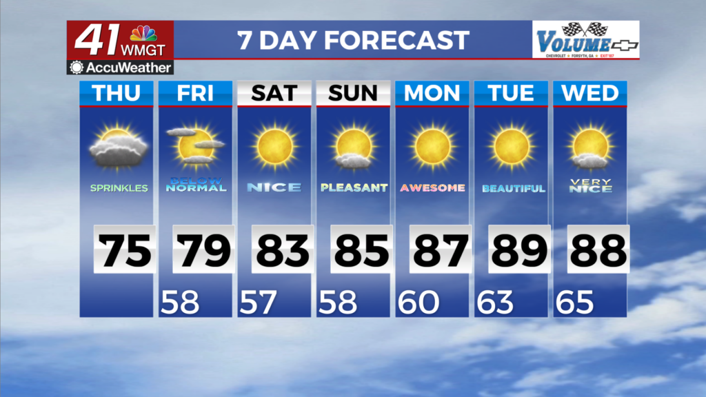
should be moving into the state later today with 40s dewpoints in the area by Friday morning. In the mid-levels, ridging that has dominated our area is being pushed back into the Southern Plains while northwest flow sets up across the east on the western side of an upper low developing over the Carolinas. That low is helping to wrap a much cooler and drier airmass southward along the Appalachians stemming from a strong ridge over New England. The end result is strong surface wedging for us and that stays in place for a few days with much cooler air along with some low clouds for a few days. We expect clouds should linger most of the day and early Friday to hinder daytime max temps with 70s generally areawide on Thursday. After today, precipitation chances 


diminish to near zero with cooler drier air in place. Forecast minimum temperatures Friday morning drop into the 50s. As the long-term period begins, our area remains situated between the eastern side of a retreating upper level ridge over southern Texas and a strengthening coastal low shifting northeastward. At the surface, the wedging pattern over our area starts to break down on Friday as northeast winds become more variable under relative high pressure. The weather impacts of this pattern will be continued drier and cooler conditions under strong subsidence through  the weekend as a Canadian airmass is cut off and shifted towards our area along the backside of the low. As a result, expect more seasonable early Fall temperatures, with highs in the mow to mid 80s through the weekend. Morning lows will dip into at least the mid to upper 50s over the bulk of our area through early next week. With drier conditions in place, rain chances remain limited through the middle of next week.