
Even more heat Tuesday afternoon
MACON, Georgia (41NBC/WMGT) – Temperatures will climb towards the triple digits Tuesday afternoon around Middle Georgia.
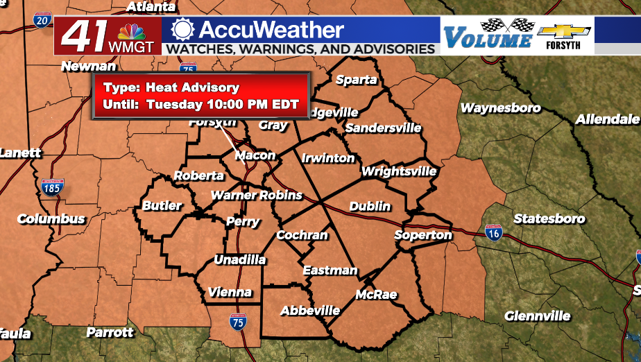
Today
Plenty of sun is again expected around Middle Georgia this afternoon along with plenty of heat. While more cloud cover is anticipated than Monday, it will largely be a thin layer of cirrus clouds blowing through the region from the northeast to the southwest. Highs will push towards 100F with heat indexes likely greater than 105 this afternoon. A heat advisory is once again in effect until 10 PM tonight. Winds will come from the northeast at about 5 mph.


Tonight skies will be partly cloudy, however a lot of that will clear ahead of Wednesday morning. Low temperatures will be in the low to mid 70s with ambient winds from the east-northeast around 5 mph.
Tropics Update
Tropical Storm Harold has formed in the Gulf of Mexico. It will make landfall near the southern tip of Texas this afternoon, so it is not of concern to Middle Georgia. Tropical Storm Franklin is the only active storm at this time with any sort of potential to hit the US. It will likely cross over the Island of Hispaniola during the day on Wednesday before continuing north into the weekend. A turn towards the west is expected over the weekend, however spaghetti plots seem to agree that Franklin will resume a northward track after an attempted westward turn. Invest 92-L is still trying to organize off the western coast of Africa and still has a 50% chance to become a named system in the next 7 days.

Follow Meteorologist Aaron Lowery on Facebook (Aaron Lowery 41NBC) and Twitter (@ALowWX) for weather updates throughout the day. Also, you can watch his forecasts Monday through Friday on 41NBC News at Daybreak (5-7 a.m.) and 41Today (11 a.m).