


Elevated rain odds continue Tuesday
MACON, Georgia (41NBC/WMGT) – Scattered storms will be likely again Tuesday afternoon following several of them Monday.
This Evening
Isolated to scattered storms are ongoing around Middle Georgia and will continue through the evening and overnight hours. A Level 1 “Marginal” threat for severe weather includes the entirety of Middle Georgia. The hazards will be isolated strong winds and some small hail.
Expect skies overnight to be mostly cloudy with lows in the mid to upper 60s. Wind will be light out of the southeast.
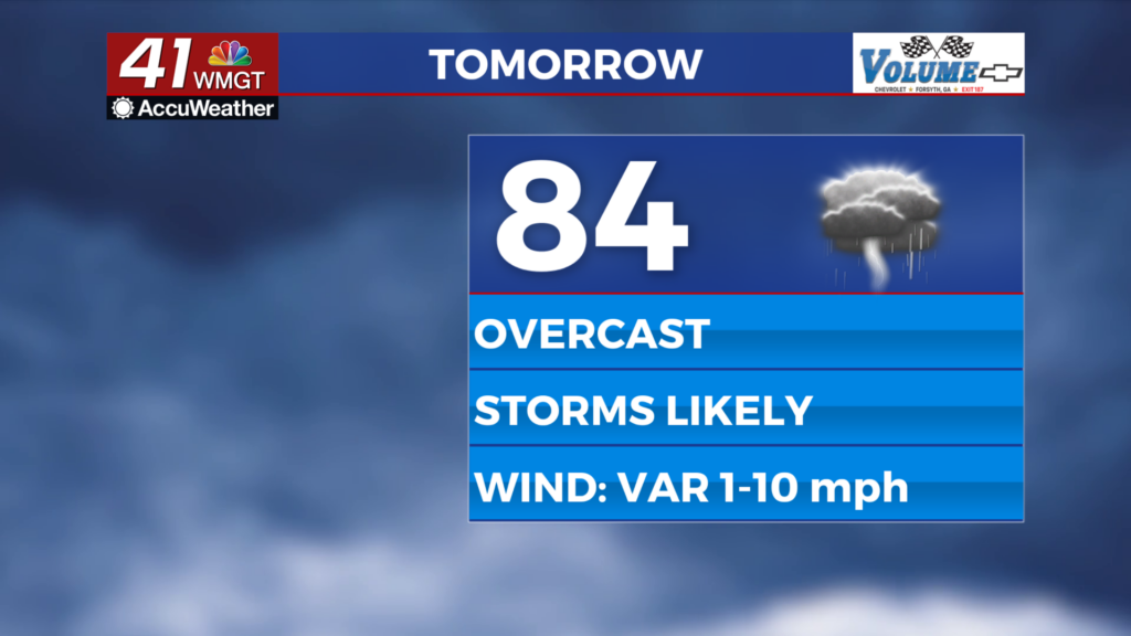
Tomorrow
A cloudy day is anticipated Tuesday across Middle Georgia with highs likely to reach into the mid to upper 80s. Wind will be light and variable through the afternoon.


Rain chances are likely, especially over the back half of the day. A Level 2 “Slight” risk includes the western parts of Middle Georgia with the rest of the region falling in the Level 1 “Marginal” risk zone. More organized storms are expected in the level 2 area which will heighten the straight line wind threat. Some hail will also be a possibility, however, and a brief tornado cannot be ruled out.


Overnight will be mostly cloudy and muggy with lows expected in the mid to upper 60s. Storms will be likely early on, however they should weaken as the night goes on. Wind will remain variable and calm.
Wednesday and Beyond
Another round of storms is likely Wednesday with the SPC already including all of Middle Georgia in a Level 1 “Marginal” threat for severe storms. Expect it to be a little less cloudy with highs pushing towards 90 degrees before rain begins later in the day. Storm chances will stay high throughout the work week, and the overall trend will remain mostly cloudy.

Follow Chief Meteorologist Aaron Lowery on Facebook (Aaron Lowery 41NBC) and Twitter (@ALowWX) for weather updates throughout the day. Also, you can watch his forecasts Monday through Friday on 41NBC News at 4, 5, 5:30, 6, and 11 p.m.
