Elevated fire risk for final weekend of Cherry Blossom Festival
MACON, Georgia (41NBC/WMGT) – An incoming cold front tonight will drop temperatures some this weekend while bringing plenty of wind and very dry air, fueling a fire threat.
This Evening


A hot and breezy afternoon will see conditions cool off a decent bit overnight. The wind will shift from the west to the north-northwest after sundown all while increasing further. This is thanks to a cold front passing through. Gusts overnight will likely reach over 20 mph in many spots. This should drop temperatures into the mid 50s for most of Middle Georgia ahead of Saturday morning. Some scattered clouds are likely overhead, especially leading into the sunrise tomorrow. There is a slim chance for a shower during this timeframe.
Tomorrow


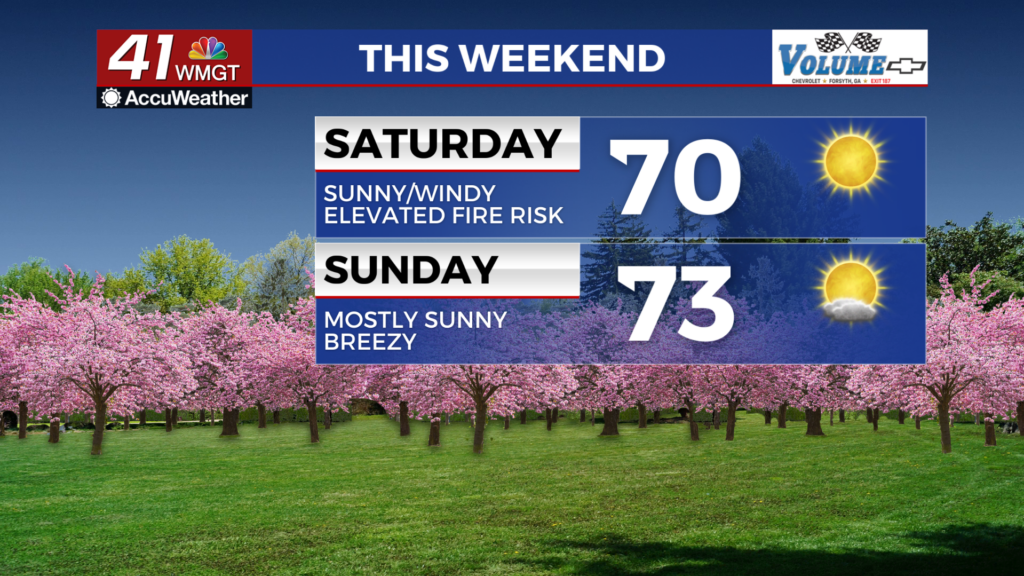
Any leftover clouds from the night will clear out during the first hours after sunrise. This will leave the rest of the day to be quite sunny. A lot of wind from the northeast is expected with sustained speeds ranging form 10-17 mph and gusts pushing as high as 30 mph. While temperatures will be cooler in the afternoon (highs around 70) the risk for fire will be rather high. This is because of very low humidity to go along with those powerful winds. Any fire that starts would be able to spread given these conditions. A Red Flag Warning is in effect from 8 AM EDT to 8 PM EDT tomorrow to account for this risk.


Overnight will still be slightly breezy as the wind becomes more easterly. Temperatures will be chilly for this time of year with lows dropping down to around 40 degrees. Overhead skies will be clear.
Sunday and Beyond


Sunday will be mostly sunny and seasonal with most highs likely in the lower 70s. The wind will flow from the east-southeast at around 6-13 mph with gusts likely reaching over 20 mph. While another Red Flag Warning is not likely a Fire Danger Statement could still be possible.

Conditions will continue to warm into next week with the 80s returning across Middle Georgia by Tuesday afternoon. The odds for isolated to scattered storms should also increase next week, hopefully bringing some relief to those suffering from elevated levels of pollen.

Follow Chief Meteorologist Aaron Lowery on Facebook (Aaron Lowery 41NBC) and X (@ALowWX) for weather updates throughout the day. Also, you can watch his forecasts Monday through Friday on 41NBC News at 4, 5, 5:30, 6, and 11 p.m.