

Dry conditions leads to daily fire weather concerns
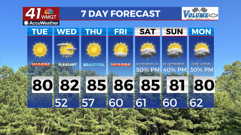
MACON, Georgia (41NBC/WMGT) – Midlevel ridging and high pressure at the surface over the Southeast will keep conditions warm and dry across the area through Wednesday. Temperatures 


 in the 40s to low 50s this morning will warm to the upper 70s to low 80s by this afternoon across most of the area under sunny skies. The air mass will slightly warm going into tomorrow, with overnight lows only falling into the 50s, and highs returning to the mid 80s by Wednesday afternoon with only a few clouds overhead. Given the very dry vegetation from the ongoing drought, this will lead to fire weather concerns both days. High pressure and midlevel ridging initially maintain control at the start of the period Thursday into Friday, leading to continued warm and dry weather. To repeat, fire danger concerns will continue to manifest each day. A welcome pattern change is on the way for the weekend, although , leading to the return for rain chances. An initial cold front begins to approach the region late Friday, into Saturday, before stalling amid a transition to zonal flow. This will signal an increasingly active pattern as a series of shortwave disturbances transition east from the weekend into early next week. While widespread soaking rainfall is unlikely at this point from the weekend into early next week, scattered showers and thunderstorms will be possible due to an increasingly moist environment. At this point, any rainfall will be welcomed. As far as severe potential, initially the highest probabilities for severe look to remain west of Georgia through Monday, though trends thereafter will need to be monitored heading into next week.