Crankin’ up the heat for the first weekend of summer
MACON, Georgia (41NBC/WMGT) – Temperatures will climb into the mid to upper 90s with heat indexes pushing the triple digits over the weekend.
This Evening


It’s another toasty afternoon across Middle Georgia. Rain odds will remain slim this evening, however one or two showers or a storm cannot be ruled out. It will be slightly cooler tonight thanks to the weak cold front yesterday. Lows will be in the upper 60s and lower 70s accompanied by a gentle wind from the north.
Tomorrow


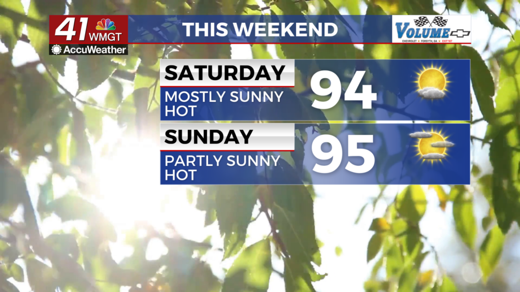
The heat will turn up more Saturday afternoon as highs reach into the mid to upper 90s. Heat indexes will hover around 100 degrees. Wind will be light and variable and skies will be mostly sunny. A stray shower cannot be ruled out, but rain is largely not expected Saturday afternoon or evening. The UV Index will likely be between 10 and 11, so sunscreen will be needed for anyone spending time outdoors.


Overnight will be mostly clear with lows in the upper 60s and lower 70s. Wind will be light from the southeast and some patchy fog will be possible. Rain is not expected.
Sunday and Beyond


It will keep getting hotter over the back half of the weekend and into the next work week. Skies should feature plenty of sunshine and rain odds will largely remain on the back burner. Actual high temperatures by the middle of next week will be where heat indexes have been over the past week. Middle Georgia could see Heat Advisories next week as heat indexes will easily eclipse 100 degrees.

Follow Chief Meteorologist Aaron Lowery on Facebook (Aaron Lowery 41NBC) and Twitter (@ALowWX) for weather updates throughout the day. Also, you can watch his forecasts Monday through Friday on 41NBC News at 4, 5, 5:30, 6, and 11 p.m.


