
Cooler finish to the week
MACON, Georgia (41NBC/WMGT) – Temperatures will be more seasonal to finish the work week following the passage of a cold front Thursday morning.
This Evening
Sunny skies returned following the severe storms that began the morning across Middle Georgia. The wind will remain quite strong through the evening with gusts pushing over 30 mph from the north-northwest. A Wind Advisory is in effect for the entirety of the region until 8 PM EDT to account for this. Overnight will be clear and chilly with several spots anticipating low temperatures just below 40 degrees. The wind overnight will be calmer from the east-northeast around 5-10 mph.
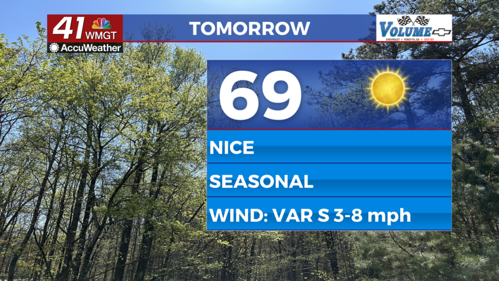
Tomorrow
A fully sunny and seasonal day will end the work week around Middle Georgia. Highs will largely be in the upper 60s however the warmest locations should still reach 70. Wind will shift from the southeast to the southwest throughout the afternoon at 5-10 mph.


Overnight will be clear again with below average temperatures for the second night in a row. This time, however, most if not all of Middle Georgia will remain above 40 degrees. The wind will be light from the west-northwest.
This Weekend and Beyond
Temperatures will bounce back over the weekend with upper 70s likely Saturday afternoon and lower 80s expected Sunday. The first half of the weekend will be a continuation of Friday with nothing but sunshine overhead. The wind will be light out of the south.


Sunday will see scattered cloud cover and isolated to scattered storms in the afternoon and evening. Another cold front is likely to pass through the region early Monday morning and given the time of year it is likely that at least parts of Middle Georgia will have another severe weather risk when that occurs.

Follow Chief Meteorologist Aaron Lowery on Facebook (Aaron Lowery 41NBC) and X (@ALowWX) for weather updates throughout the day. Also, you can watch his forecasts Monday through Friday on 41NBC News at 4, 5, 5:30, 6, and 11 p.m.