Conditions to stay cool ahead of Christmas Eve.
MACON, Georgia. (41NBC/WMGT) – Temperatures will stay cool around Middle GA on Thursday.
Today


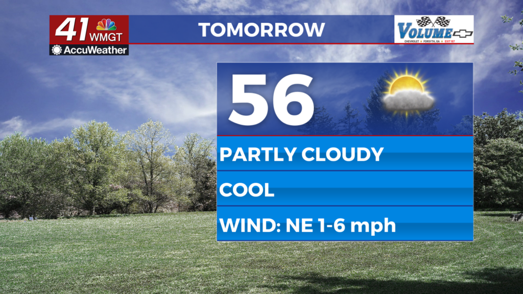
Sunny skies are back for a second straight day across Georgia. However, unlike yesterday the wind is not going to be nearly as noticeable as it shifts from the northeast in the morning to the southeast during the afternoon. Wind speeds will top out below 10 mph today, and with the direction change will no longer be advecting cool air into the Peach State. High temperatures will reach the upper 50s and lower 60s around the region under clear skies.


Overnight the skies will remain mostly clear, however the shift of the wind to the south will allow some moisture to build up. A few high level clouds are expected overnight, but that is it. Temperatures will remain on chilly side, bottoming out in the low to mid 30s.
Christmas Eve


An abundance of sunshine will stick around for Christmas Eve as well, but now with the wind blowing from the south-southwest it’s time for things to heat up. Temperatures will jump upwards of 10 degrees from Thursday to Friday as highs reach the upper 60s across Middle GA. There will be some more cirrus clouds that fill in, but that should be all for cloud cover during the day on Christmas Eve.


Overnight some more cloud cover will fill in at the mid and lower levels thanks to a weak system off to the northwest. The wind will continue to blow from the south-southwest at about 10 mph. Temperatures overnight will warm up drastically from the night prior, jumping 15 or more degrees and only falling into the low 50s and upper 40s.
Christmas

There will be a mix of sun and clouds on Christmas as things continue to warm up. Temperatures will reach the low and mid 70s around the region as southwest winds blow at 15-20 mph. Gusts could be upwards of 30 mph around Middle GA. The system off to the north will bring some isolated rain showers to the northern third of GA, but none of those should reach south of Atlanta. All we will see from that system is cloud cover; the cold front will not make it anywhere near GA.

Come Sunday we will begin to settle into a warm and moist pattern. The jet stream will be taking on more of a zonal (east-west) flow, greatly reducing the dynamics of the atmosphere for much of the US. This will keep our highs in the 70s well into next week along with a mix of sun and clouds. Beginning Sunday and continuing into next week as well scattered rain showers will be possible in the afternoon as well. This pattern will likely carry us into the New Year.


Follow Meteorologist Aaron Lowery on Facebook (Aaron Lowery 41NBC) and Twitter (@ALowWX) for weather updates throughout the day. Also, you can watch his forecasts Monday through Friday on 41NBC News at Daybreak (6-7 a.m.) and 41Today (11 a.m).


Leave a Reply