Conditions remain chilly and dry heading into firework shows tonight
MACON, Georgia (41NBC/WMGT) – Dew points will stay below 25 degrees tonight meaning conditions will be favorable for fires to start if some fireworks go awry.
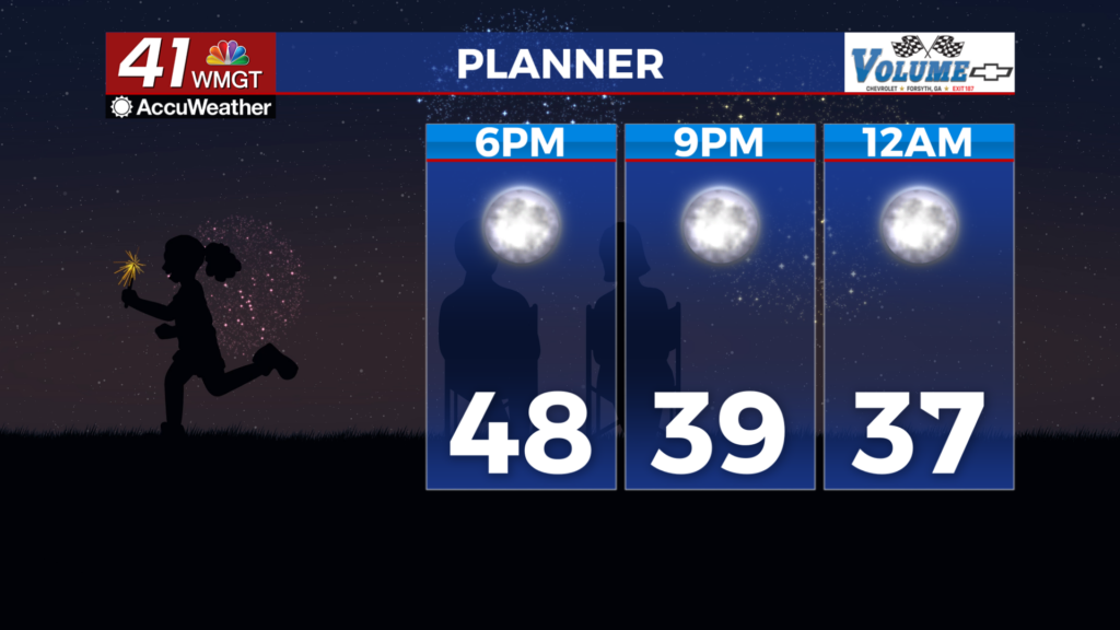
This Evening and Tonight


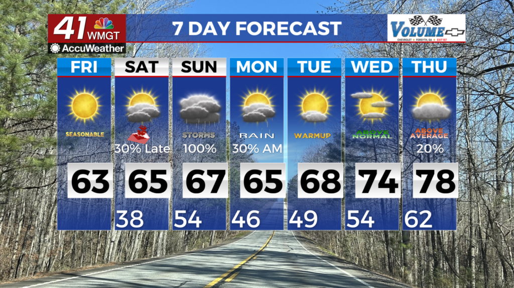
It’s been a clear afternoon around Middle Georgia with high temperatures staying a few degrees below average. Another cold night is expected with temperatures likely to be in the mid to upper 30s during the firework viewing window. Lows by tomorrow morning will hover around freezing, so while faucets don’t need to be dripped any small outdoor pets or plants should be brought in. Skies overhead will mostly be clear, however a few cirrus clouds will pass by. The wind will be light out of the west-southwest around 5-10 mph with the occasional gust to around 15 mph. Dew points will remain in the teens and low 2os tonight, so anyone putting on their own fireworks shows needs to make sure they have a way to extinguish fires should things go wrong.
New Year’s Day


Thursday will continue the warming trend as highs will return to above average conditions in the lower 60s. Skies will once again be sunny across the board. The wind will mainly flow from the west at around 5-10 mph, however a shift towards the southwest is likely during the evening hours.


Overnight will see cloud cover increase, especially after midnight. It will all be high clouds that move in however, so the sunrise should still be quite visible (and possible quite pretty) Friday morning. Overnight lows will be in the upper 30s around the region accompanied by light wind from the southwest. Some fog will also be possible leading up to/through the sunrise on Friday.
Friday and Beyond


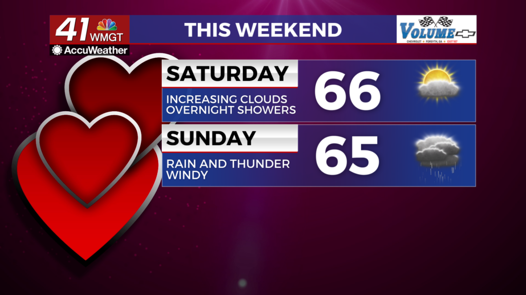
Friday will have a little bit of sun early however mid and low level clouds will move in ahead of lunchtime. A few showers will be possible in the afternoon as temperatures peak in the mid 60s with a southwest wind at 5-10 mph. Gusts could push to around 15 mph.

Rain odds will increase further Friday night as a warm front arrives. Some thunder and lightning may be possible with this activity. The clouds will hang around Saturday and another round of rain (perhaps some storms) will be possible as a cold front passes through during the afternoon. No major temperature drop is expected with this front and conditions will remain mild into the first full week of 2026.

Follow Chief Meteorologist Aaron Lowery on Facebook (Aaron Lowery 41NBC) and X (@ALowWX) for weather updates throughout the day. Also, you can watch his forecasts Monday through Friday on 41NBC News at 4, 5, 5:30, 6, and 11 p.m.