


Colder temperatures arrive for Friday
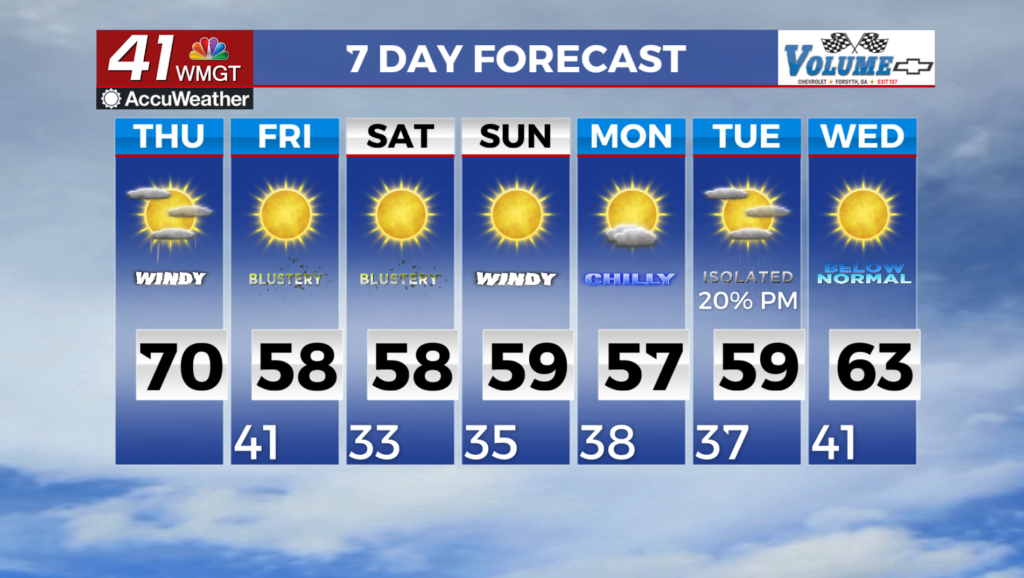
MACON, Georgia (41NBC/WMGT) – Thursday will bring cooler and breezy conditions behind the passage of a front. West-northwest winds of 10 to 15 mph with gusts up to 25 to 30 mph are 


forecast through the afternoon. High temperatures at the higher elevations are projected to be in the 50s with 60s to low 70s elsewhere. Moving into Thursday night into Friday morning, the latest guidance suggests some wrap around precipitation across our far northeastern counties. Temperatures are expected to fall into the low to mid 30s across North Georgia and low 40s in Middle Georgia. At this time precipitation does not really line up with the colder/at below freezing temperatures beyond a few points at the highest elevations so the precipitation will largely remain liquid. Additionally, with winds staying elevated during this period, chances for frost development are low. The extended period opens on Friday morning with an Arctic surface high beginning to 

dive southward across the Central U.S., accompanied by a steady stream of cold, dry air at the mid-levels. The combination of the two and the previously mentioned high pressure system settling across the Southeast will result in mostly clear and dry conditions, along with a marked drop in temperatures that will linger through the weekend and into next week. We’ll be breezy to round off the work week, with frequent gusts to 20 to 25 mph possible on Friday. Highs each day Friday through Monday will be in the 50s to lower 60s for all. Mornings will become progressively chillier through Sunday, when those venturing outside around daybreak will likely experience lows in the mid 20s to mid 30s. Areas along and north of the I-85 corridor are likely to experience a hard freeze. Rain chances will remain possible into Monday, when a shortwave approaches from the west. There is some disagreement among the models regarding the positioning of this feature. As it stands, the lingering high is nudged into place across the Mid-Atlantic on Monday, any associated moisture will over run the cool dome, which would reinforce the presiding cool, stable, airmass.