Colder conditions begin to take over Middle Georgia Wednesday
MACON, Georgia (41NBC/WMGT) – Colder and drier conditions will begin to take over Middle Georgia Wednesday; stick around through the weekend.
Today


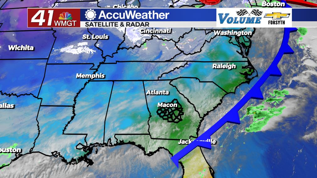
We had some pretty sunrises to begin our Wednesday around Middle Georgia. Conditions were in the low to mid 40s, or about 5 degrees cooler on average than yesterday morning across the region. It will be a cooler afternoon too as highs only climb into the mid to upper 50s. Northwest winds of 6-13 mph and gusts upwards of 20 mph will add an extra bite to the air. On top of that cloud cover will thicken a bit in the afternoon and evening. While the cold front did pass through Middle Georgia yesterday evening, the overall storm system is weak, disorganized, and messy. Systems that are more disorganized often take more time to clear out. No rain is expected today despite the added cloud cover, however.


Tonight we will see our thickest clouds: until midnight, that is. Once we pass midnight the cloud cover will rapidly clear from the northwest to the southeast leading up to Thursday morning. This will allow leftover heat from Wednesday afternoon to leave ahead of the sunrise, dropping lows into the mid to upper 30s. Ambient winds will continue to blow out of the northwest with gusts up to 20 mph, so wind chills at or below freezing will be possible to begin our Thursday in many Middle Georgia locations.
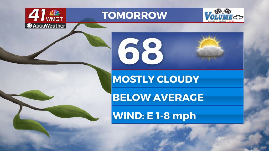
Tomorrow


Thursday will see the return of sunny skies to Middle Georgia. Despite this, it will be a colder afternoon once again for our Thursday. Highs will only reach into the low to mid 50s, and even though the wind will not be as gusty, the northwest flow will continue to make wind chills feel a degree or two colder than the actual temperature. A couple of cirrus clouds may pass through the region during the afternoon, but that should be all.


Tomorrow night will be a clear and cold one for Middle Georgia. The northwest winds will continue to feed in at 5-10 mph, and even with gusts only up to 15 mph it will be absolutely bitter rolling into Friday morning. Record setting lows are likely leading into Friday morning as temperatures bottom out in the upper 20s. Wind chills will likely be in the mid to upper 20s for much of the region.
Friday and The Weekend


Heading into Friday the Polar Vortex over eastern Canada will begin to strengthen. Despite this, it will be a slightly warmer afternoon in Middle Georgia. Local systems in the southeastern U.S. will be responsible for a slight warming into the weekend. Highs will be in the mid to upper 50s with overnight lows dropping into the lower 30s (many below freezing).
Saturday will be a bit warmer as some Middle Georgia locations climb towards the 60 degree mark. It will be sunny early with increasing clouds in the afternoon, especially for the southern half of the region. A couple of showers could be possible overnight for the southern half of the region as well, and while it will be cold, it will NOT be cold enough to even think about winter weather. The chance for showers is also low. Low temperatures will range from the mid 30s (northern half) into the lower 40s (southern half).
Sunday will see highs in the low to mid 50s under sunny skies with overnight lows dropping into the mid to upper 20s under clear skies.

Follow Meteorologist Aaron Lowery on Facebook (Aaron Lowery 41NBC) and Twitter (@ALowWX) for weather updates throughout the day. Also, you can watch his forecasts Monday through Friday on 41NBC News at Daybreak (6-7 a.m.) and 41Today (11 a.m)