Cold front tonight will drop temperatures for the rest of the week
MACON, Georgia (41NBC/WMGT) – Temperatures reached near average today however the rest of the week will return to below normal temps following a cold front overnight tonight.
This Evening


It’s been another sunny day around Middle Georgia and temperatures have climbed some since Monday afternoon. Some spots even saw double digit increases. A few more clouds are likely to move in during the evening as a cold front will pass through tonight. Odds for rain are extremely low however a small shower cannot 100% be ruled out. The wind will shift from the west-southwest to the northwest as the front passes. Expect lows to range from the upper 40s into the mid 50s ahead of Wednesday morning.
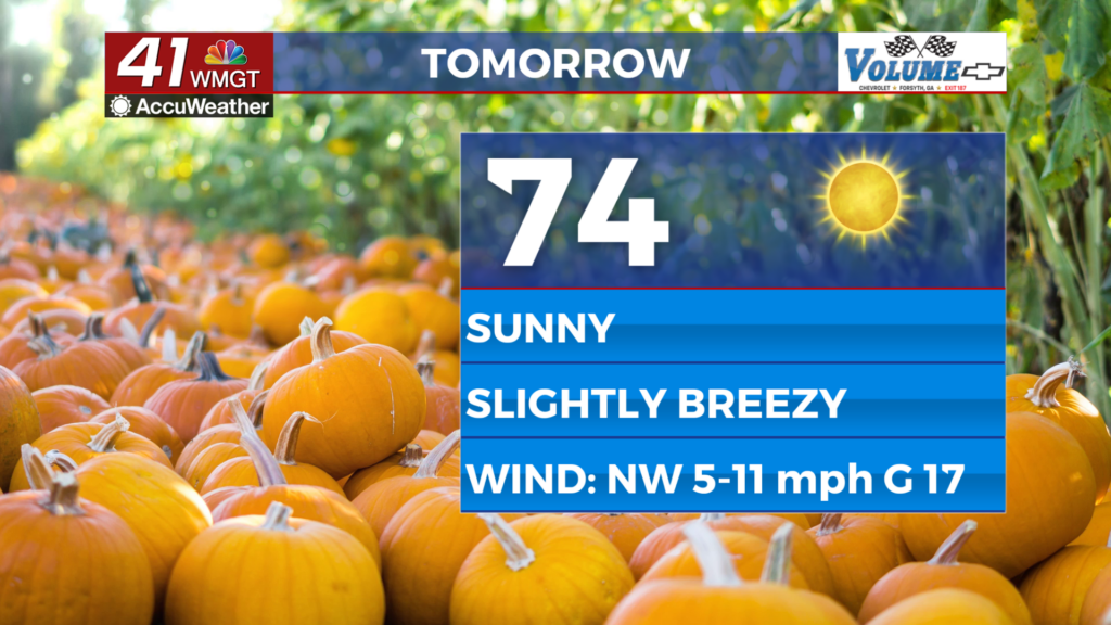
Tomorrow


A fully sunny day is likely Wednesday and those conditions will be accompanied by pleasant breezes from the northwest. Sustained speeds will range from 5-12 mph with gusts reaching to around 17 mph. Highs should reach the low to mid 70s around Middle Georgia.


Overnight will be mostly clear with lows likely in the lower 40s for most of the region. The chilliest spots may drop into the upper 30s. Wind will remain out of the northwest however it should slow to around 5 mph.
Thursday and Beyond


The rest of the week will be sunny with highs likely in the mid-upper 70s. Wind will be light as it shifts from the north towards the east ahead of the weekend. Rain odds should stay low until Sunday evening/Monday of next week.
The Tropics

Tropical Storm Melissa has been named in the southern Caribbean. As of now it is expected to meander northward towards the gap between Cuba and the Island of Hispaniola. If it should get north of those islands it may become of concern to the Southeastern US.

Follow Chief Meteorologist Aaron Lowery on Facebook (Aaron Lowery 41NBC) and X (@ALowWX) for weather updates throughout the day. Also, you can watch his forecasts Monday through Friday on 41NBC News at 4, 5, 5:30, 6, and 11 p.m.