Cold front to bring storms to Middle Georgia Friday
MACON, Georgia (41NBC/WMGT) – An incoming cold front will bring afternoon and evening thunderstorms ahead of a pleasant weekend.
This Evening


A partly sunny afternoon will become a partly cloudy night across Middle Georgia. Wind will continue to flow from the south at around 7-15 mph with gusts upwards of 20 mph. It will become more southwesterly by tomorrow morning. Tonight is the warmest night of the week as temperatures largely only fall into the lower 50s. The coolest spots may dip into the upper 40s.
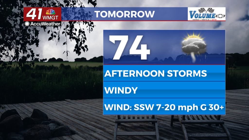
Tomorrow


Friday will be mostly cloudy with storms expected over the back half of the day. Severe weather is not expected despite temperatures climbing into the mid to upper 70s across the region, however lightning and thunder will be likely. Ambient wind will also be rather strong from the south-southwest as it ranges from 10-20 mph, gusting over 30 mph at times. Most if not all of the region will see rain, and the vast majority will likely hear thunder.


Rain will linger into the night before clearing the southeastern counties at around midnight. Lows will fall into the mid to upper 40s ahead of Saturday morning as wind becomes more westerly at 5-10 mph.
This Weekend and Beyond


It will be warm and sunny all weekend across Middle Georgia as temperatures reach the upper 60s Saturday and lower 70s Sunday. Sunday is also Groundhog day, and the sunny conditions will likely support General Beauregard Lee seeing his shadow. However, some clouds from overnight Saturday could potentially complicate that early Sunday. Regardless of what Lee calls for, temperatures will stay well above average into next week.

Follow Chief Meteorologist Aaron Lowery on Facebook (Aaron Lowery 41NBC) and Twitter (@ALowWX) for weather updates throughout the day. Also, you can watch his forecasts Monday through Friday on 41NBC News at 4, 5, 5:30, 6, and 11 p.m.


