


Cold front to bring more storms Friday
MACON, Georgia (41NBC/WMGT) – An incoming cold front will bring more rain to Middle Georgia ahead of Mother’s Day weekend.
This Evening
There has been a good deal of sun around Middle Georgia this afternoon, however a bit more cloud cover and isolated to scattered storms will be possible through the evening and into tonight. A Level 1 “Marginal” risk for severe weather includes all counties except for the northernmost parts of the region. Those counties are included in the Level 2 “Slight” risk. This is due to increased odds for larger hail with any storms that get going. The main hazards with any storms will be some hail or a few strong wind gusts. The tornado threat is extremely low, but not quite zero. Storms will remain possible past midnight tonight, however the rain should be done by tomorrow’s sunrise.


Aside from storms it will be a mostly cloudy night with light and variable winds. Fog will be possible, especially in areas that see storms. Lows will be in the low to mid 60s.
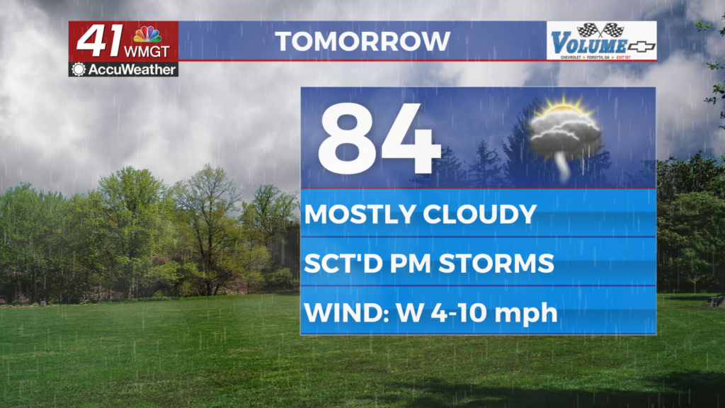
Tomorrow
Mostly cloudy conditions are likely Friday with a bit of sun in the afternoon. An incoming cold front will spur on some storms over the later parts of the day, especially over the southern half of the region. Highs will reach the mid to upper 80s before any storms get going. Ambient wind will flow from the west at 5-10 mph.


A Level 1 “Marginal” risk includes all of Middle Georgia tomorrow. Hail and a few wind gusts will be the primary threats, however with the incoming front a brief tornado cannot be ruled out. Depending on timing, however those threats may be reduced if the rain is mainly overnight.


Overnight will be wet and cloudy as thunderstorms shift to more of a stratiform rain leading into Saturday morning. Lows will be in the low to mid 60s accompanied by light and variable winds.
Mother’s Day Weekend
The weekend looks soppy as the cold front from Friday is expected to stall out somewhere between Middle Georgia and the state line with Florida. This will spur on multiple rain chances through both Saturday and Mother’s Day on Sunday. Saturday’s highs will likely only be in the mid 60s while Sunday will be more in the upper 60s and lower 70s. The rainy pattern will carry into next week.

Follow Chief Meteorologist Aaron Lowery on Facebook (Aaron Lowery 41NBC) and Twitter (@ALowWX) for weather updates throughout the day. Also, you can watch his forecasts Monday through Friday on 41NBC News at 4, 5, 5:30, 6, and 11 p.m.
